Map and Travel Bookshop
We offer a huge range of maps, travel books and other travel accessories.
-
New Products
-

Admiralty Chart 1283 – Defeng Gang and Approaches
Admiralty standard nautical charts comply with Safety of Life at Sea (SOLAS) regulations and are ideal for professional, commercial and recreational use. Charts within the series Read More » -

Gap – Montagne de Ceuse IGN 3338ET
Topographic survey of France at 1:25,000 in IGN`s excellent TOP25 / Sรฉrie Bleue series. All the maps are GPS compatible, with a 1km UTM grid plus Read More » -

101 Mediterranean Dishes
Even if it is raining outside, this little book of sunshine will help lift the gloom with a wealth of comforting, cheerful dishes to keep the Read More » -

Warminster & Trowbridge – Westbury & Mere OS Explorer Active Map 143 (waterproof)
Warminster, Trowbridge, Westbury and Mere area on a detailed topographic and GPS compatible map No. 143, waterproof version, from the Ordnance Survey’s 1:25,000 Explorer series. MOBILE Read More » -

Female Explorers` Atlas
From the dawn of civilization, mankind has been inspired to explore and discover the world around him. This atlas, with its beautiful illustrations and wealth of Read More » -
Anna Fekete
-

Japan, Light and Shadows in the land of the Rising Sun
With one eye toward the future and one looking to the past, Japan is a world of striking contrasts that translate dramatically to the medium of Read More » -
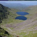
Carrauntoohil and MacGillycuddy`s Reeks
The MacGillycuddy`s Reeks are Ireland`s highest mountains with Carrauntoohil tallest at 1039m. Occupying about 100 square km., they stretch from the picturesque Gap of Dunloe in Read More » -
Taramundi
-
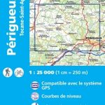
Perigueux – Tocane-Saint-Apre IGN 1834SB
Topographic survey of France at 1:25,000 in IGN`s excellent TOP25 / Sรฉrie Bleue series. All the maps are GPS compatible, with a 1km UTM grid plus Read More »
-
-
Featured Products
-

Castrocontrigo CNIG Topo 230-4
-

NP52 North coast of Scotland Pilot
It covers the North and Northeast Coasts of Scotland from Cape Wrath to Rattray Head including the Caledonian Canal, Orkney Islands, Shetland Islands and Fรธroyar (Fรฆroe Read More » -

The Man Who Loved Children
All the June Saturday afternoon Sam Pollit`s children were on the lookout for him as they skated round the dirt sidewalks and seamed old asphalt of Read More » -

Set of 3 Moleskine Black Large Plain Journals
Sold in packs of three, the Cahier is a light notebook which has evolved from the original Moleskine design. It has a heavy-duty cardboard cover and Read More » -

Porvoo
The 1:50,000 topographic map gives a more general picture of the ground features than a basic map. It shows settlements, houses, roads, cultivated areas, waterways, cutting Read More » -

Across an Inland Sea
How do the places we live in and visit shape our lives and memories? What does it mean to reside in different locations across the span Read More » -

SHOM Chart 7155L – Du Cap Frรฉhel ร la Pointe du Grouin – Approches de Saint-Malo – Leisure A4 size
LEISURE FORMAT – FOLDED TO A4 SIZE AND PRINTED ON WATER RESISTANT PAPER.PLEASE NOTE: the chart will be ordered for you if not currently in stock. Read More » -

The Map of Love
In 1900, Lady Anna Winterbourne travels to Egypt where she falls in love with Sharif, an Egyptian Nationalist utterly committed to his country`s cause. A hundred Read More » -

Socotra Bradt Guide
This new, full-colour title is the first and only guide available to the largest of the four islands that make up the UNESCO World Heritage Site Read More » -

Steamboat Springs CO Trail Map
The Steamboat Springs Adventure Map is a waterproof, topographic trail map (lat/long,UTM grids) that includes route descriptions covering trails throughout the Steamboat Springs area as well Read More »
-
Categories
-
Best Sellers
-

Laois – Offaly – Tipperary OSI Discovery 54
Map No. 54, Laois North West in the Discovery series from the OSI, the Ordnance Survey of Ireland, which presents the country on detailed topographic maps Read More » -

Must Eat NYC: An Eclectic Selection of Culinary Locations
Restaurant guides exist in different shapes and sizes, but this is the first guide that focuses on the โ€must eatโ€ of a restaurant. Where do you Read More » -

La Garrovilla CNIG Topo 777-1
-

St Petersburg: Three Centuries of Murderous Desire
`This extraordinary book brings to life an astonishing place. Beautiful prose renders brutality vivid` The Times – BOOK OF THE WEEK From Peter the Great to Read More » -

Super Structures
From the Ancient Pyramids to the Eiffel Tower, get ready to take a close-up look at man-made structures. Super Structures is a unique interactive book that Read More » -

Davit-launched liferaft (2019)
Photoluminescent Vinyl – 150mm x 150mm.Stanfords is an official distributor of Maritime Progress safety signs. We are able to source a full range of their products Read More » -

Admiralty Chart DE42 – Kiel Canal
NEW EDITION OUT ON 26/08/2021***Chart image for illustration only. Actual product may vary due to changes applied to the newest edition*** Plan included in this chart:Cuxhaven Read More » -

Iran Reise Know-How
Waterproof and tear-resistant, indexed road map of Iran at 1:1,500,000 with topographic and tourist information, published by Reise Know-How as part of their highly acclaimed World Read More » -

Sea Lights
At night we sail over the inky black sea,me and my dad, in our little red boat.We cast out our nets, and we wait in the Read More »
-


