Disclosure : This site contains affiliate links to products. We may receive a commission for purchases made through these links.
Padis Dimap Hiking Map
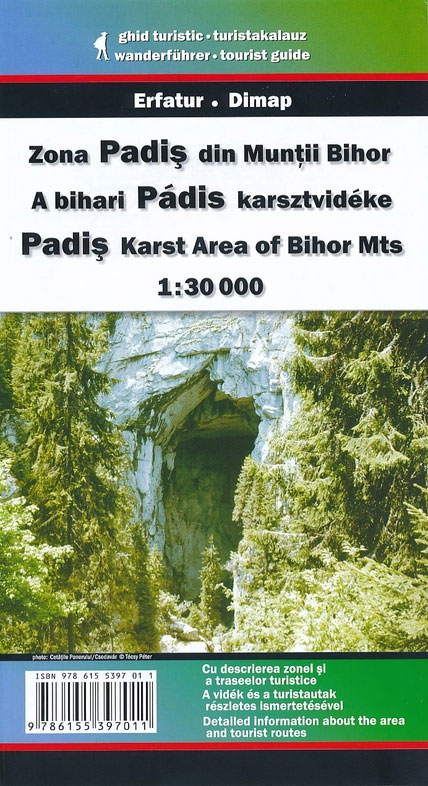
Padis area at 1:30,000 in a series of detailed contoured maps covering popular hiking areas of Transylvania published by Dimap, one of Hungary’s leading publishers specializing in mapping of that region. The maps show local hiking routes and provide tourist information such as campsites, places of interest, etc. Many titles include street plans and/or English language descriptions of recommended hiking trails.*In this title:* hiking map with contours at 50m intervals, highlighting several local footpaths and trails indicating their waymarking signs. Symbols show local hotels, campsites, and mountain huts, springs and waterfalls, caves and rock faces, places of interest, etc. Three small insets show the Galbenei and Somesului Cald gorges and the Ponorului depression at enlarged scales. The map has no geographical coordinates. On the reverse is a black and white road map at 1:400,000 showing the surrounding region and notes, in Hungarian and German only, describing the area and the various hiking routes. *Map legend includes English.*

Related Products:
 Parang Mountains Dimap Hiking Map
 Bihor Mountains Dimap Hiking Map
 Retezat Mountains Dimap Hiking Map
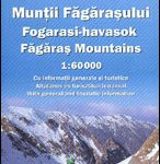 Fagaras Mountains Dimap Hiking Map
 Gilau Mountains Dimap Hiking Map
Tarcau Mountains and Ghimes Dimap Hiking Map
St Anna Lake Dimap Hiking Map
Gurghiu Mountains Northern and Central Dimap Hiking Map
Caliman Mountains Dimap Hiking Map
Gilau Mountains Dimap Hiking Map
Tarcau Mountains and Ghimes Dimap Hiking Map
St Anna Lake Dimap Hiking Map
Gurghiu Mountains Northern and Central Dimap Hiking Map
Caliman Mountains Dimap Hiking Map
 Giurgeu and Hasmas Mountains Dimap Hiking Map
Rarau-Giumalau Mountains and Bucovina Monasteries Dimap Hiking Map
Romania: Dimap Hiking Maps
Giurgeu and Hasmas Mountains Dimap Hiking Map
Rarau-Giumalau Mountains and Bucovina Monasteries Dimap Hiking Map
Romania: Dimap Hiking Maps
 Rodnei Mountains Dimap Hiking Map
 Piatra Craiului – Bucegi – Postavarul – Piatra Mare – Ciucas Mountains Dimap Hiking Map
 Switzerland K+F Long-Distance Hiking Routes Map
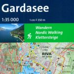 Lake Garda: Trento – Brescia – Verona 35K Kompass Hiking Atlas No. 2752
 Poland: Compass Hiking Maps
 Bulgaria: Domino Hiking Maps
 NP Kellerwald-Edersee – Habichtswald NP – Medebach Hiking Region Kompass 845
 Germany: Freytag & Berndt Hiking and Leisure Maps
 Cรฉvennes – Gorges du Tarn IGN 75011
 Allgรคu 35K Kompass Hiking Atlas No.2751
 Nepal: Nepa Trekking and Hiking Maps
Austria/Germany/Slovenia: Kompass Hiking Maps
Nepal: Nepa Trekking and Hiking Maps
Austria/Germany/Slovenia: Kompass Hiking Maps
 Geneva Region K+F Hiking Map 21
 Cederberg Mountains Hiking Set (2-map set)
Italy: Kompass 50K Hiking Maps
Cederberg Mountains Hiking Set (2-map set)
Italy: Kompass 50K Hiking Maps
 Salzburg Region Freytag & Berndt Hiking Atlas
 Hungary: Cartographia Hiking Maps
 Germany: Kรผmmerly+Frey Hiking and Recreational Maps
 Greece: Terrain Editions Maps for Hiking and Recreational Pursuits
 Heidiland – UNESCO Tectonic Arena Sardona 50K K+F Hiking Map No. 33
 Eqi Hiking Map
 Spain: Editorial Piolet Hiking Maps
 El Ports: Southern Stars Long-distance Hiking Route
 Slovenia: Kartografija 40K Hiking and Cycling Sets
 Bern K+F Hiking Map 9
 Czech Republic: Kompass 50K Hiking Maps
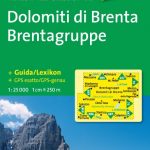 Italy: Kompass 25K/40K Hiking Maps of the Dolomites
 Val d`Aran: Setau Sagรจth Hiking Circuit