Disclosure : This site contains affiliate links to products. We may receive a commission for purchases made through these links.
Pacific Coast Mexican SEMAR charts
Official Mexican Hydrographic Office charts (SEMAR – Secretarรญa de Marina Armada de Mรฉxico) offer a great range of scales for ports along the Mexico`s Pacific coast. Available to order from Stanfords. Also available:- General and Regional charts of Mexico- Charts for ports along the Gulf of Mexico and the Caribbean coastFor more information, please email maritime@stanfords.co.uk .

Related Products:
 SEMAR Chart 4 – Gulf of Mexico and Caribbean Sea
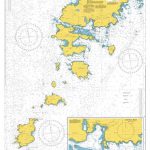
SEMAR Chart 001 – Zona Economica Exclusiva – Mexico Coast and Approaches
SEMAR Chart 713.1 – La Pesca, Tamaulipas
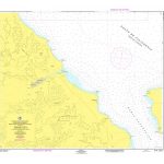
SEMAR Chart 722.1 – Altamira and Approaches
SEMAR Chart 811.3 – Isla Lobos
SEMAR Chart 812.2 – Tuxpan, Veracruz
SEMAR Chart 721 – La Pesca to Punta Jerez
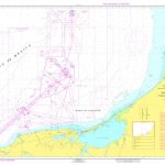
SEMAR Chart 722.3 – Rio Panuco – Puerto de Tampico
SEMAR Chart 812.5 – Laguna de Tampamachoco, Veracruz
SEMAR Chart 813.3 – Laguna Verde, Veracruz
SEMAR Chart 233.2 – San Carlos, Sonora
SEMAR Chart 233.4 – Guaymas, Sonora
SEMAR Chart 301.1 – Isla los Alijos
SEMAR Chart 4 – Gulf of Mexico and Caribbean Sea
SEMAR Chart 001 – Zona Economica Exclusiva – Mexico Coast and Approaches
SEMAR Chart 713.1 – La Pesca, Tamaulipas
SEMAR Chart 722.1 – Altamira and Approaches
SEMAR Chart 811.3 – Isla Lobos
SEMAR Chart 812.2 – Tuxpan, Veracruz
SEMAR Chart 721 – La Pesca to Punta Jerez
SEMAR Chart 722.3 – Rio Panuco – Puerto de Tampico
SEMAR Chart 812.5 – Laguna de Tampamachoco, Veracruz
SEMAR Chart 813.3 – Laguna Verde, Veracruz
SEMAR Chart 233.2 – San Carlos, Sonora
SEMAR Chart 233.4 – Guaymas, Sonora
SEMAR Chart 301.1 – Isla los Alijos
 SEMAR Chart 323.2 – Bahia Pichilingue
 SEMAR Chart 363.4 – Mazatlan, Sinaloa
 SEMAR Chart 323.3 – La Paz
 SEMAR Chart 200 – California Gulf, Northern Part
SEMAR Chart 711.3 – Puerto de Matamoros, Tamaulipas (El Mezquital)
SEMAR Chart 200 – California Gulf, Northern Part
SEMAR Chart 711.3 – Puerto de Matamoros, Tamaulipas (El Mezquital)
 SEMAR Chart 232.2 – Mulege, Baja California Sur
 SEMAR Chart 323.4 – Isla Espiritu Santo
SEMAR Chart 334.2 – Punta Colorada, Sinaloa
SEMAR Chart 323.4 – Isla Espiritu Santo
SEMAR Chart 334.2 – Punta Colorada, Sinaloa
 SEMAR Chart 720 – La Pesca to Tampico
 SEMAR Chart 840 – Bahia de Campeche
 SEMAR Chart 523.3 – Acapulco
SEMAR Chart 813.1 – Nautla, Veracruz
SEMAR Chart 523.3 – Acapulco
SEMAR Chart 813.1 – Nautla, Veracruz
 SEMAR Chart 922.4 – Isla Cozumel