Disclosure : This site contains affiliate links to products. We may receive a commission for purchases made through these links.
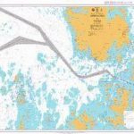
Paลกman Island Croatian Mountain Rescue Service 25K Map

Paลกman Island with the surrounding smaller islands and the mainland around Biograd Na Moru on a contoured and GPS compatible map at 1:25,000 from the Croatian Mountain Rescue Service. Contours at 10m intervals enhanced by relief shading provide excellent presentation of the terrain, with markings for various topographic features. Waymarked hiking paths are highlighted. Symbols indicate various facilities and places of interest, including different types of tourist accommodations (hotels, apartments, campsite), restaurants, beaches, etc. The map has a 1km UTM grid, plus latitude and longitude lines at 1’ intervals. On the reverse are extensive bilingual notes illustrated with colour photos. Map legend and the notes include English.This map is printed on demand, and if it`s out of stock it could take 3 – 4 months waiting time.To see the list of titles in this series please click on the series link.

Related Products:
 Mljet Island Croatian Mountain Rescue Service 20K Map
 Ugljan, Rivanj & Sestrunj Islands Croatian Mountain Rescue Service 25K Map
 Dugi, Iลพ & Sestrunj Islands Croatian Mountain Rescue Service 25K Map
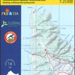 Loลกinj Island Croatian Mountain Rescue Service 25K Map
 Biokovo Mountains Croatian Mountain Rescue Service 25K Map
 Paklenica National Park Croatian Mountain Rescue Service 25K Map
 Istria: Cicarija Plateau Croatian Mountain Rescue Service 25K Map
 Kameลกnica Mountain Croatian Mountain Rescue Service 25K Map
 Rab Island Croatian Mountain Rescue Service 25K Map
 Croatia: Mountain Rescue Service Recreational Maps
 Easter Island / Rapa Nui
 Lastovo Islands Nature Park
 Valjevo Mountain Range
 Rajac Mountain
 Easter Island & Santiago ITMB
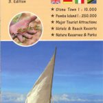 Zanzibar – the Spice Island
 Table Mountain
 Auckland & North Island ITMB
 Ljubljana and Environs Kartografija Tourist Map
 Posavsko Hribovje Kartografija Tourist Map
 Vancouver Island ITMB
 Eqi – Alluttoq – Arveprinses Island
 Primorska Kartografija Tourist Map
 Stajerska – Slovene Hills – Haloze – Boc Kartografija Tourist Map
 Appalachian Trail: Schaghticoke Mountain to East Mountain Hiking Atlas, CT/MA
 Lebanon & Beirut ITMB
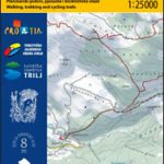
 Julian Alps West Kartografija Tourist Map
 Villasimius – Torre delle Stelle – Costa Rei
 Bulgaria (with Mountain Resorts)
 Baunei
 Triglav National Park Kartografija WATERPROOF Hiking Map
 Notranjski Kras – Brkini – Dolenjska – Bela Krajina Kartografija Tourist Map
 North York Moors Harvey British Mountain Map XT40
 Prince Edward Island ITMB
 Orosei
 Omiลกka Dinara
 Rakiura / Stewart Island – North West Circuit Rakiura NP
 Skadar Lake National Park
 Slovenia: Kartografija 75K Hiking Maps
 South East Queensland – featuring Landcruiser Mountain Park Hema Explorer Map