Disclosure : This site contains affiliate links to products. We may receive a commission for purchases made through these links.
Pรฉcs
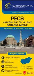
Pรฉcs in a series of street plans of Hungary’s main towns from Cartographia in Budapest. The plans cover the whole town with its outer suburbs and, where appropriate, have an enlargement for the central area. All the plans have a street index.Map legend varies; in plans of larger towns or popular tourist destinations it usually includes English.Many plans also include additional features: insets with plans of larger satellite developments or villages, lists of sights and/or various municipal offices and facilities, etc. Some titles include on the reverse a road map of the town’s environs or the administrative province.*In this title:* English map legend; an enlargement for the city centre at 1:10,000; a list of over 200 places of interest, services and facilities; a road map of the Baranya province at 1:200,000 (map legend in Hungarian only).

Related Products:
 Eger
Eger
 Szeged
 Miskolc
 Debrecen
Gyor
Debrecen
Gyor
 Siofok
 Nagykanizsa – Zalakaros
 Veszprรฉm
 Kaposvar
 Szolnok
Balatonfรผred – Tihany
Szolnok
Balatonfรผred – Tihany
 Erd and Environs
 Szekesfehervar – Fejer County
 Zalaegerszeg – Zala County
Kecskemรฉt (with Kiskunsรกg National Park)
Zalaegerszeg – Zala County
Kecskemรฉt (with Kiskunsรกg National Park)
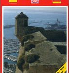 Alicante and the Towns of the Alicante Province
 Ragusa Global Map Street Plan
Salerno
Ragusa Global Map Street Plan
Salerno
 Arad – Timisoara Cartographia Street Plan
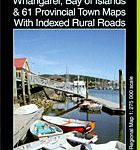 Northland: Whangarei, Bay of Islands and 61 Provincial Towns Pathfinder
 Nuremberg Falk EXTRA Street Plan
La Spezia
Bremen Falk EXTRA Street Plan
Hanover Falk EXTRA Street Plan
Nuremberg Falk EXTRA Street Plan
La Spezia
Bremen Falk EXTRA Street Plan
Hanover Falk EXTRA Street Plan
 Ulm – Neu-Ulm Extra
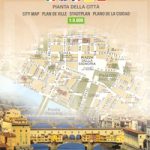 Florence Global Map Street Plan
Trier Falk EXTRA Street Plan
Munich Falk Cityplan
Florence Global Map Street Plan
Trier Falk EXTRA Street Plan
Munich Falk Cityplan
 Gรถttingen EXTRA
 Hanover EXTRA
Lรผbeck EXTRA
Hanover EXTRA
Lรผbeck EXTRA
 Monchengladbach EXTRA
Munster EXTRA
Saarbrucken EXTRA
Frankfurt am Main Falk EXTRA Street Plan
Monchengladbach EXTRA
Munster EXTRA
Saarbrucken EXTRA
Frankfurt am Main Falk EXTRA Street Plan
 Dortmund EXTRA
 Flensburg EXTRA
Kiel EXTRA
Oberhausen EXTRA
Flensburg EXTRA
Kiel EXTRA
Oberhausen EXTRA