Disclosure : This site contains affiliate links to products. We may receive a commission for purchases made through these links.
Oxford 1898 – 33.15
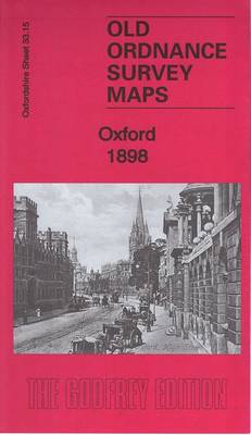
Oxford in 1898 in a fascinating series of reproductions of old Ordnance Survey plans in the Alan Godfrey Editions, ideal for anyone interested in the history of their neighbourhood or family. Two maps of Oxford are published in this series; they link up with each other to provide quite good coverage of the city, though some outlying areas, including the station, are not yet covered.The OXFORD map covers the centre and north of the city, stretching from Parkend Street and the LNWR station (on the margin of the map) eastward to New Marston, and from Church Street and Pembroke Street northward to Norham Gardens. Features include most of the Colleges, including Balliol, Jesus, Exeter, Trinity, St John’s, Worcester, Somerville, Keble, Christ Church (at the foot of the map), All Souls, Corpus Christi, Merton, Queen`s, All Souls, Magdalen, St Edmund Hall, Wadham, Mansfield. Other features include Magdalen Bridge, Botanic Gardens, St Clement`s church, River Cherwell, Mesopotamia Walk, Radcliffe Library, Radcliffe Observatory, County Hall, Cornmarket Street, Clarendon Press, St Giles Street, St Giles churc and Radcliffe Infirmary. Street directories for Broad Street, George Street, High Street, Holywell Street, St Giles Street are on the reverse. The SOUTH OXFORD map continues coverage south, covering an area from Pembroke College a mile southward to New Hinksey, and from the Hinksey Stream eastward to Hurst Street. Features include the Cathedral, New Street, Folly Bridge, Trinity church, St Matthew`s church, Grandpont, Abingdon Road. The Thames or Isis runs through the centre of the map and east of that are the University Running Ground, St Hilda`s, Donnington Nursery, Iffley Road, St John`s church, Christchurch Meadow, Bullingdon Road, etc. Street directories for Abingdon Road, Black Friars Road, Cambridge Street, Friars Street, Friars Wharf, Iffley Road, Isis Street, St Aldgate`s Street and Speedwell Street are on the back. About the Alan Godfrey Editions of the 25″ OS Series:Selected towns in Great Britain and Ireland are covered by maps showing the extent of urban development in the last decades of the 19th and early 20th century. The plans have been taken from the Ordnance Survey mapping and reprinted at about 15 inches to one mile (1:4,340). On the reverse most maps have historical notes and many also include extracts from contemporary directories. Most maps cover about one mile (1.6kms) north/south, one and a half miles (2.4kms) across; adjoining sheets can be combined to provide wider coverage.FOR MORE INFORMATION AND A COMPLETE LIST OF ALL AVAILABLE TITLES PLEASE CLICK ON THE SERIES LINK.

Related Products:
 South Oxford 1898 – 39.03
 Newcastle-under-Lyme 1898 – 17.04b
 That Sweet City – Visions of Oxford
 Barry 1898 – 50.04a
Wallasey Village 1898
Barry 1898 – 50.04a
Wallasey Village 1898
 Newbury 1898 – 43.01
Central Croydon 1895 – 14.10
Rock Ferry and New Ferry 1898
Newbury 1898 – 43.01
Central Croydon 1895 – 14.10
Rock Ferry and New Ferry 1898
 Stoke upon Trent (South) 1898 – 18.05
Darlington West 1898
Stoke upon Trent (South) 1898 – 18.05
Darlington West 1898
 Oxford: Faden`s Map 1789
 Darlington 1898 – 55.06a
 Darlington (South) 1898 – 55.10a
Manchester Oxford Street and Gaythorn 1849
Friern Barnet and New Southgate 1898
Duns & Greenlaw 1898 – 16.07
Darlington (South) 1898 – 55.10a
Manchester Oxford Street and Gaythorn 1849
Friern Barnet and New Southgate 1898
Duns & Greenlaw 1898 – 16.07
 Norwich (South) 1905 – 63.15
Campbeltown 1898 – 257.08
Norwich (North) 1905 – 63.11
Alston 1898
Bidston 1898
Cockermouth 1898
Norwich (South) 1905 – 63.15
Campbeltown 1898 – 257.08
Norwich (North) 1905 – 63.11
Alston 1898
Bidston 1898
Cockermouth 1898
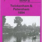 Twickenham & Petersham 1894 – 122
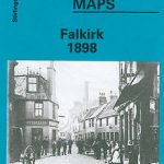 Falkirk 1898
The West End 1914 – 61.3
Falkirk 1898
The West End 1914 – 61.3
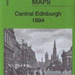 Central Edinburgh 1894 – 3.07
Stranton & Southern Hartlepool 1896 – 37.15
Central Edinburgh 1894 – 3.07
Stranton & Southern Hartlepool 1896 – 37.15
 Cambridge (North) 1901 – 40.14
Victoria Park 1889
Annan 1898
Oxford, Witney and District 1893
Cambridge (North) 1901 – 40.14
Victoria Park 1889
Annan 1898
Oxford, Witney and District 1893
 Altrincham 1908
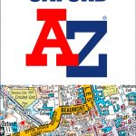 Oxford A-Z Pocket Street Map
Sheffield Ecclesall Road and Sharrow 1903
Oxford A-Z Pocket Street Map
Sheffield Ecclesall Road and Sharrow 1903
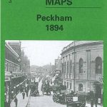 Peckham 1894 – 103.2
 Kidsgrove 1898
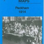 Peckham 1914 – 103.3
Oban 1898 – 98.07
Peckham 1871 – 103.1
Bridgnorth 1901
Peckham 1914 – 103.3
Oban 1898 – 98.07
Peckham 1871 – 103.1
Bridgnorth 1901