Disclosure : This site contains affiliate links to products. We may receive a commission for purchases made through these links.
Overberg Whale Coast
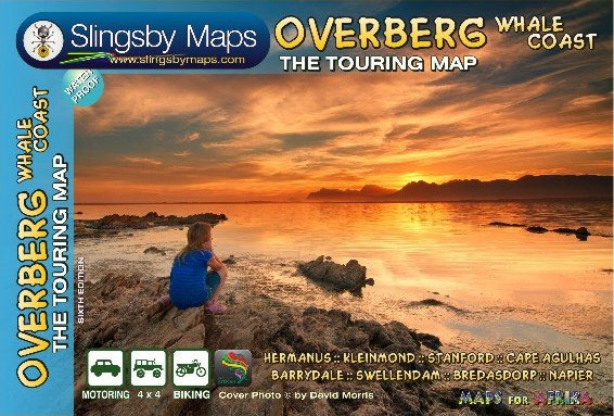
Overberg Whale Coast on a very attractive and detailed, double-sided map from Slingsby Maps, with many additional street plans and area maps. Relief is depicted by elevation tinting, spot heights, and contours at 100m intervals. Road information includes minor gravel roads, private road, mountain passes and intermediate driving distances on most roads. Routes which are particularly attractive – or conversely, worth avoiding – are indicated. Railways are marked, showing local stations. Symbols depict an enormous range of features: accommodation and camping sites, farm stalls and other local produce shop (cheese, dried or fresh fish, olives, etc.), wine cellars, breweries, various outdoor recreation sites (golf, paragliding, etc), landmarks, monuments, nature reserves, animal and bird watching sites, botanical sights, wheel-chair routes, etc. Latitude and longitude lines are drawn at 5’ intervals.A particular feature of the map is its depiction of the coastal areas, where the overprint indicates not only the usual facilities founds in such places: best beaches, yachting, diving, board sailing, angling, but also the best places for spotting whales, plus sites of numerous shipwrecks with dates when sunk, going back to the 17th century.Inset maps at 1:25,000 or larger scale are arranged around the main map and on the reverse. These display enlargements of 25 towns and localities, including Hermanus, Bredasdorp, Betty`s Bay, Gansbaai, Kleinmond, Montagu, Swellendam, etc., with relief, accommodation, petrol stations, and other facilities marked. Contact details for further tourist information resources are provided. The map was researched and drawn by Peter Slingsby – renowned environmental educator and cartographer.To see other titles in this series please click on the series link.

Related Products:
 Wild Coast: East London – Port St Johns – Port Edward
 North Sea Coast – Bremen – Hamburg K+F Regional Road Map
 Baltic Sea Coast – Hamburg – Berlin K+F Regional Map
 Klaipeda and the Northern Coast
Klaipeda, Kuronian Spit and the Southern Coast
Klaipeda and the Northern Coast
Klaipeda, Kuronian Spit and the Southern Coast
 Baviaanskloof Mega-Reserve
 Mexico Pacific Coast & Guadalajara ITMB
 Croatia – Dalmatian Coast 3-Map Set Kompass 2900
 Cederberg Mountains Hiking Set (2-map set)
 Norway North – Narvik F&B
 Dalmatian Coast North – Krk ‘“ Cres ‘“ Loลกinj ‘“ Rab ‘“ Pag – Zadar Kompass 2901
 Norway South – Oslo – Bergen – Stavanger F&B
 Fehmarn Island – The Baltic Coast of Schleswig-Holstein 50K Kรผmmerly + Frey Map No. 11
 Norway North Cape – Hammerfest F&B
 Norway: Freytag & Berndt Regional Road Maps
 Norway Central – Trondheim ‘“ Lillehammer – Alesund F&B
 Croatia: Kompass 100K Maps of the Dalmatian Coast
 Olympic Peninsula and Washington Coast, WA
 Schleswig-Holstein – Hamburg F&B Road and Leisure Map
 Berlin – Brandenburg – Magdeburg F&B Road and Leisure Map
 Namibia Map Studio Adventure Map
 Belgian Coast Cycling Map 30
 Rugen – Mecklenburg-Vorpommern F&B Road and Leisure Map
Montenegro Coast
Rugen – Mecklenburg-Vorpommern F&B Road and Leisure Map
Montenegro Coast
 East Frisia – Munsterland – Bremen F&B Road and Leisure Map
 Hanover – Harz – East Westphalia F&B Road and Leisure Map
 Westphalia – Rhineland-Palatinate – Saarland F&B Road and Leisure Map
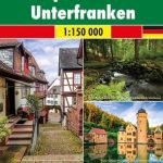
 Saxony – Thuringia – Upper Franconia F&B Road and Leisure Map
 Franconia – Altmuhltal – Bavaria East F&B Road and Leisure Map
 Greater Stuttgart F&B Top 10 Tips
 Greater Frankfurt F&B Top 10 Tips
 Upper Bavaria – Lower Bavaria – Swabia F&B Road and Leisure Map
 Pilbara and Coral Coast Hema Waterproof Map
 Malawi Map Studio Adventure Map
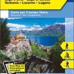 Lake Maggiore – Lake Orta – Lake Varese K+F Outdoor Map 8
 Thuringian Forest – Spessart – Lower Franconia F&B Road and Leisure Map
 Black Forest – Swabian Alb – Lake Constance F&B Road and Leisure Map
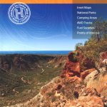
 New South Wales Hema
 Transkei Wild Coast
 Baltic Coast Coast – Lubeck to the Danish Border 2-Map Set Kompass 724