Disclosure : This site contains affiliate links to products. We may receive a commission for purchases made through these links.
Ouistreham (Pegasus Bridge) 1944

Ouistreham (Pegasus Bridge) in a series of reproductions of the Bigot Plans prepared by the GSGS (Geographic Section General Staff) for the D-Day landings in Normandy in June 1944, showing German defences and other obstacles facing the invading Allied troops. The map is centred on the bridge that is now known as Pegasus Bridge, near Bรฉnouville and Ranville, the scene of the heroic glider landings. The map is double-sided, extending from Ouistreham in the north southward to Herouvillette and westward beyond Cazelle.The Bigot Plans were classified Top Secret and issued under the highest level of “Need to Know” regulations. They were updated with aerial and intelligence information to 19th May 1944, less than three weeks before the landings. The reprints, taken from the 1:25,000 series catalogued as GSGS 4347, are very detailed and show the terrain, obstacles and defences that the Allied forces expected to meet, with blue colour indicating those confirmed and purple those not verified. Each sheet has a topographic legend, with the two maps covering the Omaha Beach and the Sword and Juno Beaches also carrying an extensive Defence Legend for defence works, weapon types, obstacles, minefields, personnel accommodation, etc. Also provided are notes about the D-Day Landing and the particular area covered by each map.* PLEASE NOTE: only three sheets have been published so far, covering Omaha Beach, Sword and Juno Beaches, and the Pegasus Bridge area. Maps shown in grey on our series grid have not been reproduced.

Related Products:
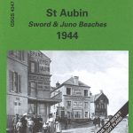 St Aubin – Sword & Juno Beaches 1944 – 40/18 SW
 St Pierre du Mont (Omaha Beach) 1944
 France: Alan Godfrey Reproductions of the GSGS Bigot Plans for the D-Day Landings
 Normandy D-Day – 6 June 1944 IGN Map
 Major & Mrs Holt`s Definitive Battlefield Guide to the D-Day Normandy Landing Beaches: 75th Anniversary Edition with GPS References
 D-Day: The Battle of Normandy, 6th June 1944 Orep Editions Historical Map
 Omaha Beach: Normandy 1944
 The Normandy D-Day Landing Beaches Major & Mrs Holt`s Battle Map
 D-Day and the Battle for Normandy Traveller`s Guide
 Landing Beaches
 6th Airborne: Normandy 1944
 Koln (S) 1944: Cologne Sheet 2
 Koln (N) 1944: Cologne Sheet 1
 The Definitive Battlefield Guide to the D-Day Normandy Landing Beaches
 Normandy 1944 – The Atlantic Wall
 Caen – Ouistreham – Plages du Debarquement IGN 1612OT
 Hagen 1944 British War Office Survey Map
 Hohensyburg and Westhofen 1944 British War Office Survey Map
 Road to Liberty 1944/1945 Michelin Map
 Snow and Steel: Battle of the Bulge 1944-45
 Forgotten Voices of D-Day: A Powerful New History of the Normandy Landings in the Words of Those Who Were There
 Dortmund North 1944 British War Office Survey Map
 Duisburg North: Hamborn and Bruckhausen 1944 British War Office Survey Map
 Battle of Normandy Michelin Map
 101st Airborne: Market Garden 1944
 SHOM Chart 7421L – De la Pointe de La Percรฉe ร Ouistreham – Leisure A4 size
 The Cruel Victory: The French Resistance and the Battle for the Vercors 1944
 SHOM Chart 7418 – Abords du Havre et d’Antifer – Embouchure de la Seine – De Ouistreham au Cap d’Antifer
 Six Armies in Normandy: From D-Day to the Liberation of Paris June 6th-August 25th,1944
 The D-Day Atlas: Anatomy of the Normandy Campaign
 Blackhill and Shotley Bridge 1895
 The Gothic Line 1944 – 1945: Western Section Ed. Multigrapic Map
SHOM Chart 7421 – De la Pointe de La Percรฉe ร Ouistreham
The Gothic Line 1944 – 1945: Western Section Ed. Multigrapic Map
SHOM Chart 7421 – De la Pointe de La Percรฉe ร Ouistreham
 Ardennes 1944: Hitler`s Last Gamble
 The D Day landing Beaches – The Guide
 Walks around Windermere & Kendal – Newby Bridge – Staveley & Grange-over-Sands
 Anzio Landings: Operation Shingle & the Battle for Rome Ed. Multigraphic Map
 Admiralty Chart 2136 – Pointe De La Percee to Ouistreham
 Normandiefront
Aberdeen (Bridge of Don) 1899 – 75.03
Normandiefront
Aberdeen (Bridge of Don) 1899 – 75.03