Disclosure : This site contains affiliate links to products. We may receive a commission for purchases made through these links.
Ottawa National Forest MI
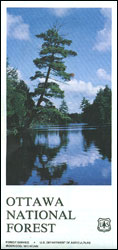
Ottawa National Forests on the shore of Lake Superior in Michigan on a detailed, double-sided map at 1:126,720 from US Forest Service showing different types of roads and trails, including snowmobile and canoe routes, campgrounds and recreational areas, etc.The map shows the area with colouring indicating different administrative status and the degree of protections or public access. Road network indicates improved light duty roads, dirt tracks and trails, as well as national recreation trails, canoe routes and snowmobile trails. Symbols show locations Forest Service campgrounds and picnic areas, trailer sanitary stations, sites for various recreations pursuits, golf courses, etc. Accompanying notes include explanations about road access and a table of facilities in the developed recreational areas. A separate inset provides a map of the nearby McCormick Wilderness.

Related Products:
 Mark Twain National Forest – Houston, Rolla and Cedar Creek Ranger District
 Oglala National Grassland, Nebraska National Forest and Samuel R. McKelvie National Forest
 Prince Albert NP, Saskatchewan
USA: Trails Illustrated Maps of National Parks, Forest and Other Recreational Areas
Prince Albert NP, Saskatchewan
USA: Trails Illustrated Maps of National Parks, Forest and Other Recreational Areas
 Allegheny National Forest North PA/NY NGS Trails Illustrated Map 738
 Manti La Sal National Forest UT
 Angeles National Forest CA
 Huron National Forest MI
 Hoosier National Forest IN
 Caribbean National Forest – Puerto Rico NGS Trails Illustrated Map 790
 Los Padres National Forest West CA
 Los Padres National Forest East CA
 Manistee National Forest North MI
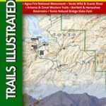
 Superstition & Four Peaks Wilderness Areas – Tonto National Forest AZ
 Manistee National Forest South MI
 Allegheny National Forest South PA
 Clinch Ranger District – Jefferson National Forest VA/KY NGS Trails Illustrated Map 793
 Fontana and Hiwasee Lakes – Nantahala National Forest NC NGS Trails Illustrated Map 784
 Big Sur – Ventana Wilderness – Los Padres National Forest CA
Allegheny National Forest
Big Sur – Ventana Wilderness – Los Padres National Forest CA
Allegheny National Forest
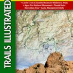
 Mazatzal & Pine Mountain Wilderness Areas – Tonto National Forest AZ
 Shaver Lake – Sierra National Forest CA
 Bradshaw Mountains – Prescott National Forest AZ
Auyuittuq National Park, Nunavut
Bradshaw Mountains – Prescott National Forest AZ
Auyuittuq National Park, Nunavut
 Merced and Tuolumne Rivers – Stanislaus National Forest CA
 Pisgah National Forest – Linville Gorge – Mt. Mitchell NC
 Tahoe National Forest – Yuba & American Rivers CA
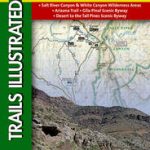 Salt River Canyon – Tonto National Forest AZ
 Superior National Forest – Boundary Waters East MN
 Superior National Forest – Boundary Waters West MN
 Tellico & Ocoee Rivers – Cherokee National Forest TN
 Uinta National Forest – Lone Peak – Mt. Timpanogos UT
 Chattahoochee National Forest – Springer and Cohutta Mountains GA/SC 777
 Green Mountain National Forest – Moosalamoo NRA – Rutland VT
 Hellsgate – Salome & Sierra Ancha Wilderness Areas – Tonto National Forest AZ
 Tahoe National Forest – Sierra Buttes / Donner Pass CA
 Crystal Basin – Silver Fork – Eldorado National Forest CA
 Chattahoochee National Forest – Brasstown Bald – Chattooga River GA/SC
 Franconia Notch – Lincoln – White Mountain National Forest NH 740
 Yosemite National Park Area