Disclosure : This site contains affiliate links to products. We may receive a commission for purchases made through these links.
Oslo Cappelen Street Atlas
Street Atlas of Oslo in a spiral-bound format from Norway’s leading cartographic publishers Cappelen, presenting the capital and its environs at several scales, with additional diagrams of its metro, railways and tram networks.The city with its suburbs is covered at 1:20,000; the centres of Oslo itself plus of Drammen, Asker, Sandvika and Drรธbak are also shown in greater detail at 1:10,000. The maps very clearly present the city’s road and rail/tram infrastructures, highlighting main traffic routes and showing one way streets, tramlines with stops, etc. Streets are annotated with selected house numbers for easier identification of addresses. A very wide range of symbols indicate various facilities, including hotels, restaurants, etc. The city’s northern suburbs are covered at 1:40,000 or 1:50,000; the whole of the Oslo region is also presented at 1:150,000 on maps indicating which areas are shown in greater detail on other pages of the atlas. Map legend includes English.

Related Products:
 Greater Oslo Cappelen Street Plan
 Zurich Pocket Street Atlas
 Riga and Vicinity Jana Seta Street Atlas
 Sofia Street Atlas with Vitosha Massif
 Geneva: Greater Geneva Street Plan
 Warsaw – Lomianki – Zabki ExpressMap Street Plan
 Riga City Center Jana Seta Street Plan
Greater Vienna F&B Street Atlas
Riga City Center Jana Seta Street Plan
Greater Vienna F&B Street Atlas
 Gothenburg Pocket Atlas
 Wroclaw ExpressMap Street Plan
 Poznan ExpressMap Street Plan
 Katowice ExpressMap Street Plan
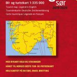 Southern Norway South – Oslo – Stavanger – Bergen – Hardangervidda Cappelen Sectional Road Map
 Gdansk – Gdynia – Sopot (The Tricity) ExpressMap Street Plan
 Szczecin – Swinoujscie – Police ExpressMap Street Plan
 Manchester A-Z Big Street Atlas SPIRAL-BOUND
 Bolton – Bury A-Z Street Atlas
 Glasgow – Hamilton – Motherwell – Paisley A-Z Street Atlas
 Bristol – Bath A-Z Street Atlas
 Kingston upon Hull – Barton-upon-Humber – Beverley A-Z Street Atlas
Kielce ExpressMap Street Plan
Kingston upon Hull – Barton-upon-Humber – Beverley A-Z Street Atlas
Kielce ExpressMap Street Plan
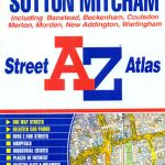 Croydon – Purley – Sutton – Mitcham A-Z Street Atlas
 Bournemouth – Poole – Christchurch A-Z Street Atlas
 Aberdeen A-Z Street Atlas
 Lublin – Swidnik ExpressMap Street Plan
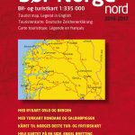
 Southern Norway North – Oslo – Bergen – Rondvassbu – Galdhopiggen Cappelen Sectional Road Map
 Manhattan Block-by-Block Street Atlas
 Chelmsford – Braintree – Maldon – Witham A-Z Street Atlas
 Jurmala Jana Seta Street Plan
 Helsinki Region Street Atlas
 Huddersfield – Batley – Cleckheaton – Dewsbury – Mirfield A-Z Street Atlas
 Colchester – Clacton-on-Sea – Harwich – Sudbury A-Z Street Atlas
 Leicester – Lutterworth – Market Harborough A-Z Street Atlas
 Krakรณw – Niepolomice – Skawina – Wieliczka ExpressMap Street Plan
 Budapest Bicycle Atlas
 Skopje Street Atlas
 Swansea – Bridgend – Carmarthen – Llanelli – Neath A-Z Street Atlas
 Kingston upon Thames – Richmond – Epsom – Wimbledon A-Z Street Atlas
 Torbay – Brixham – Paignton – Torquay A-Z Street Atlas
Lodz ExpressMap Street Plan
Torbay – Brixham – Paignton – Torquay A-Z Street Atlas
Lodz ExpressMap Street Plan