Disclosure : This site contains affiliate links to products. We may receive a commission for purchases made through these links.
Orsรฉg – Gรถcsej – Kemeneshat Cartographia Tourist Map 21
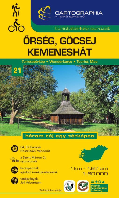
Orsรฉg – Gรถcsejin a series of contoured hiking and recreational maps from the Budapest based Cartographia, with hiking routes and other tourist information, including in many titles street plans, cycling trails, etc. The maps have contours at 10m intervals with relief shading and spot heights, plus colouring and/or graphics to indicate different types of vegetation. An overprint highlights local hiking paths, with cycling routes also included in some titles. Symbols mark various places of interest, sport and recreational facilities, including campsites and other tourist accommodation, locations of petrol stations, etc. The maps show 1km lines of the country’s national grid. Map legends are in Hungarian and German only. On the reverse many titles include street plans of holiday centres and further information on the area, in Hungarian only.

Related Products:
 Borzsony Cartographia Tourist Map 5
 Bรผkk Cartographia Tourist Map 29
 Vรฉrtes Cartographia Tourist Map 20
 Mรกtra Cartographia Tourist Map 14
 Zselic Cartographia Tourist Map 17
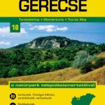 Gerecse Cartographia Tourist Map 10
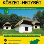 Koszeg Hills Cartographia Tourist Map 13
 Buda Hills Cartographia Tourist Map 6
 Danube Bend Cartographia Tourist Map 31
 Cserhat – Karancs – Medves Cartographia Tourist Map 8
 Mecsek – Villรกny Mountains Cartographia Tourist Map 15
 Zemplen Hills North Cartographia Tourist Map 22
Pilis – Visegrad Hills Cartographia Tourist Map 16
Zemplen Hills North Cartographia Tourist Map 22
Pilis – Visegrad Hills Cartographia Tourist Map 16
 Zemplen Hills South Cartographia Tourist Map 23
 Lake Balaton Cartographia Tourist Map 4
 Gรถmรถr – Tornai-Karszt – Cserehรกt Cartographia Tourist Map 1
Hungary: Cartographia Hiking Maps
Gรถmรถr – Tornai-Karszt – Cserehรกt Cartographia Tourist Map 1
Hungary: Cartographia Hiking Maps
 Gemenc – Szekszard-Hills Tourist Map
 Lake Balaton Cartographia Leisure Map
 Lake Balaton II West Cartographia Water Sports & Cycling Map
Orsรฉg – Gรถcsej – Vasi Mountains Cartographia Tourist Map
Szigetkoz – Tokoz – Czilizkoz
Lake Balaton II West Cartographia Water Sports & Cycling Map
Orsรฉg – Gรถcsej – Vasi Mountains Cartographia Tourist Map
Szigetkoz – Tokoz – Czilizkoz
 Hungary: Cartographia Hiking Guides
Karkonosze ExpressMap Tourist Map
Hungary: Cartographia Hiking Guides
Karkonosze ExpressMap Tourist Map
 Argentina: de Dios Tourist Maps of Popular Regions
 Swietokrzyskie Mountains ExpressMap Tourist Map
Sudetes West ExpressMap Tourist Map
Beskid Sadecki ExpressMap Tourist Map
Swietokrzyskie Mountains ExpressMap Tourist Map
Sudetes West ExpressMap Tourist Map
Beskid Sadecki ExpressMap Tourist Map
 Drava Cartographia Water Sports & Cycling Map
Klodzko Environs ExpressMap Tourist Map
Slowinski National Park ExpressMap Tourist Map
Nadmorski Regional Park – Hel Peninsula ExpressMap Tourist Map
Warsaw Environs ExpressMap Tourist Map
Bieszczady ExpressMap Tourist Map
Krakรณw Environs ExpressMap Tourist Map
Drava Cartographia Water Sports & Cycling Map
Klodzko Environs ExpressMap Tourist Map
Slowinski National Park ExpressMap Tourist Map
Nadmorski Regional Park – Hel Peninsula ExpressMap Tourist Map
Warsaw Environs ExpressMap Tourist Map
Bieszczady ExpressMap Tourist Map
Krakรณw Environs ExpressMap Tourist Map
 Gรณry Stolowe ExpressMap Tourist Map
 Kaszuby – Kashubian Landscape Park ExpressMap Tourist Map
Suwalki Region ExpressMap Tourist Map
Kaszuby – Kashubian Landscape Park ExpressMap Tourist Map
Suwalki Region ExpressMap Tourist Map
 Beskid Slaski ExpressMap Tourist Map
Western Tatra Mountains Polish and Slovak ExpressMap Tourist Map
Beskid Slaski ExpressMap Tourist Map
Western Tatra Mountains Polish and Slovak ExpressMap Tourist Map