Disclosure : This site contains affiliate links to products. We may receive a commission for purchases made through these links.
Orosei
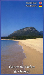
Sardinia’s eastern coast around the town of Orosei on a detailed, contoured, GPS compatible map at 1:35,000 from Abies Edizioni, with on the reverse notes on the area’s history, heritage and beaches. Contours are at 20m intervals with colouring for different types of vegetation. The map shows local footpaths and hiking trails, as well as recommended mountain bike routes. Symbols highlight various places of interest including campsites, beaches, diving and surfing sites, viewpoints, climbing sites, nuraghi, churches, etc. The map has a 1-km UTM grid. On the reverse are multilingual notes about the area and its heritage. Map legend and the notes include English.


