Disclosure : This site contains affiliate links to products. We may receive a commission for purchases made through these links.
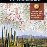
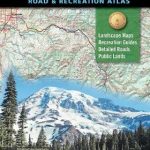
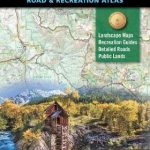
Oregon Benchmark Road & Recreation Atlas
Oregon at 1:225,000 in a series of excellent, detailed, GPS compatible state atlases from Benchmark Maps with extensive information on diverse recreational opportunities and facilities, covering The Rockies and the western states of the United States. Each atlas consists of three main sections:*Landscape:* with detailed mapping at scales around 1:250,000, according to the size of the state. Excellent use of relief shading and altitude colouring provides a vivid picture of the topography, with plenty of names of physical features such a mountain and hill ranges, peaks, valleys, etc. All heights are given in feet. Boundaries of national parks, state forests, Indian reservations and military areas are marked. The presentation of the road network includes finely graded paved roads, 4WD tracks and other unclassified roads (rough 4WD tracks, logging and private roads, etc). Symbols highlight various recreational facilities. The maps are fully GPS compatible, with a latitude and longitude grid at 10’ intervals plus margin ticks at 1’. The section has an index with separate lists of towns and settlements; rivers and other water features; mountain ranges, peaks, valleys, etc; parks, wildernesses and recreational areas.*Recreation:* less detailed mapping to provide a better overview of the state, still with relief shading but with colouring indicating different ownership or land use: national parks, wilderness areas, state lands or parks, military areas, etc. Places of interest and recreational facilities are highlighted. Each page of mapping has opposite it a page with a recreational guide, listing national or state parks, forests and wildlife areas, numerous and varied recreational facilities (boating, rafting, fishing, hunting, skiing, etc) all presented with brief descriptions and contact details. Campgrounds and RV parks are either included here, or listed separately page by page at the end of the section. Also provided are climate charts plus a key to the more detailed, landscape pages for the same area. *Regional:* an overview section which provides a map of the whole state, indexed and showing coverage of it in the Recreation section. Also included is mapping of the surrounding wider region with the neighbouring states, and of the whole US, each with a distance table to the state capital.*In this title:* the Recreational section has mapping at 1:750,000. In the Landscape section additional pages at 1:125,000 cover the area around Portland.

Related Products:
 Idaho Benchmark Road & Recreation Atlas
 Oregon Road & Recreation Atlas
 Montana Benchmark Road & Recreation Atlas
 New Mexico Benchmark Road & Recreation Atlas
 California Benchmark Road & Recreation Atlas
 Wyoming Benchmark Road & Recreation Atlas
 Arizona Benchmark Road & Recreation Atlas
 Washington State Road & Recreation Atlas
 Nevada Road & Recreation Atlas
 USA: Benchmark Road and Recreational Atlases of Western USA
 Greater Yellowstone & Grand Teton Benchnark Maps Recreation Atlas & Guide
 Oregon Benchmark Recreational Map
 Washington State Benchmark Recreation Map
 Utah Benchmark Recreation Map
 Oregon Recreational Atlas & Gazetteer
 Oregon & Northern California Coast Road & Recreation Map
 Alaska Benchmark Road & Recreation Atlas
 USA: Antenna Audio American Highway Road Atlas – A4, PAPERBACK
 Pennsylvania Recreation Atlas
 USA NGS Adventure Edition Road Atlas A3 SPIRAL-BOUND
 Utah Benchmark Road & Recreation Atlas
 California Benchmark Road Map
 Highway 395 – Carson City NV to Lone Pine CA Benchmark Road Map
USA: Benchmark Maps State Road Maps
Highway 395 – Carson City NV to Lone Pine CA Benchmark Road Map
USA: Benchmark Maps State Road Maps
 Italy Road Atlas A4 PAPERBACK
 Alberta MapArt Back Road Atlas
 USA Hema The Ultimate Road Atlas A3 SPIRAL-BOUND
New Zealand Kiwimaps Travellers Road Atlas
USA Hema The Ultimate Road Atlas A3 SPIRAL-BOUND
New Zealand Kiwimaps Travellers Road Atlas
 Australia UBD Gregory`s Road Atlas A4 SPIRAL-BOUND
 Canada – USA – Mexico Road Atlas
 Baltic States Regio Road Atlas
 Saskatchewan Back Road Atlas
 Slovenia Kartografija Road Atlas
 USA: Antenna Audio American Highway Road Atlas – A3, PAPERBACK
 Idaho Benchmark Recreational Map
 Colorado Benchmark Road & Recreation Atlas
 Wyoming Recreational Atlas & Gazetteer
 Montana Recreational Atlas & Gazetteer
 Ontario MapArt Back Road Atlas
 New Mexico Benchmark Recreation Map