Disclosure : This site contains affiliate links to products. We may receive a commission for purchases made through these links.
Omiลกka Dinara
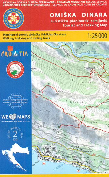
Omiลกka Dinara Mountains on the Adriatic coast of Croatia on a contoured and GPS compatible, double-sided map at 1:25,000 from the Croatian Mountain Rescue Service. Coverage extends from Dugi Rat and Omiลก to just beyond Vruja and inland beyond the A1 motorway to the hill along the Cetina River. Contours at 20m intervals enhanced by relief shading provide excellent presentation of the terrain, with markings for various topographic features. On the reverse the same area of the Omiลกka Dinara Mountains but with coverage extending less far inland is shown with contours at 10m intervals and additional altitude colouring. Both maps highlight waymarked hiking paths and indicate which local roads and tracks are suitable for cycling. Symbols show various facilities and places of interest, including different types of tourist accommodations (hotels, campsites, mountain refuges), restaurants, etc. Both maps have a 1km UTM grid. Also provided are notes about the Omiลกka Dinara Mountains. Map legend and the notes include English.This map is printed on demand, and if it`s out of stock it could take 3 – 4 months waiting time.To see the list of titles in this series please click on the series link.

Related Products:
 Dinara – Troglav Group West
 Dinara – Troglav Group East
 Dinara
 Western Tatras – Polish and Slovak
 Tatra Mountains PL/SK
 Rodnei Mountains Dimap Hiking Map
 Suva Mountains
 Gurghiu Mountains Northern and Central Dimap Hiking Map
 Beskid Maly
 Beskid Zywiecki
Tarcau Mountains and Ghimes Dimap Hiking Map
Rarau-Giumalau Mountains and Bucovina Monasteries Dimap Hiking Map
Beskid Zywiecki
Tarcau Mountains and Ghimes Dimap Hiking Map
Rarau-Giumalau Mountains and Bucovina Monasteries Dimap Hiking Map
 Parang Mountains Dimap Hiking Map
 Bihor Mountains Dimap Hiking Map
 Biokovo Mountains Croatian Mountain Rescue Service 25K Map
 Volterra and its Environs Edizioni Multigraphic 513
 Retezat Mountains Dimap Hiking Map
 Karavanke Mountains – Kep to Kosuta Kartografija WATERPROOF Hiking Map
 Valjevo Mountain Range
 Cederberg Mountains Hiking Set (2-map set)
 Fagaras Mountains Dimap Hiking Map
Gilau Mountains Dimap Hiking Map
Fagaras Mountains Dimap Hiking Map
Gilau Mountains Dimap Hiking Map
 Mecsek – Villรกny Mountains Cartographia Tourist Map 15
 Parco Regionale Migliarino – S. Rossore – Massaciuccoli Edizioni Multigraphic 503
 Paลกman Island Croatian Mountain Rescue Service 25K Map
 Slovenia: Kartografija 75K Hiking Maps
 Ugljan, Rivanj & Sestrunj Islands Croatian Mountain Rescue Service 25K Map
 Mljet Island Croatian Mountain Rescue Service 20K Map
 San Gimignano – Colle Val d`Elsa – Poggibonsi Edizioni Multigraphic 511
 Lastovo Islands Nature Park
 Pirin (BG) – Orvilos – Vrontou (GR) Geopsis 134
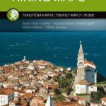
 Primorska Kartografija Tourist Map
Caliman Mountains Dimap Hiking Map
Primorska Kartografija Tourist Map
Caliman Mountains Dimap Hiking Map
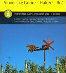 Stajerska – Slovene Hills – Haloze – Boc Kartografija Tourist Map
 Triglav National Park Kartografija WATERPROOF Hiking Map
 Alt Empordรก 2-Map Set Editorial Alpina
 High Tatras Kompass 2130
 Rajac Mountain
 Ljubljana and Environs Kartografija Tourist Map