Disclosure : This site contains affiliate links to products. We may receive a commission for purchases made through these links.
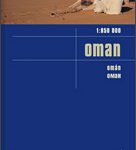
Oman and United Arab Emirates Wall Map

Oman and United Arab Emirates Wall Map at 1:1,250,000 from Gizi Map, size 74 x 94cm (29″ x 37″ approx), with excellent presentation of the topography, many place names in both Arabic and Latin script, oil or gas rigs and pipelines in the southern Persian Gulf, etc.Bold altitude colouring shows the topography, with additional graphics for deserts, salt flats, wadis, oasis, springs, etc, plus coral reefs in coastal waters and bathymetric tinting of the seas. The map has plenty of names of various geographical features: deserts, mountain ranges, etc. In Oman names of town and villages are in both Arabic and Latin alphabet, as are topographic features throughout the whole map. Road network includes desert tracks and shows distances on main routes and locations of border crossings. Domestic airports and ports are marked. Within Oman administrative boundaries and names of the provinces are shown and in UAE names of the individual Emirates. Also marked, both on land and in the southern part of the Gulf, are numerous gas and oil wells, plus the pipelinesSymbols highlight various places of interest, including UNESCO World Heritage sites and numerous diving locations. Latitude and longitude lines are drawn at 1ยฐ intervals. The index is next to the map. Map legend includes English and Arabic.Please note: this title is also available in a folded format.

Related Products:
 Oman – United Arab Emirates Gizi Map
 United Arab Emirates – Dubai – Abu Dhabi Reise Know-How
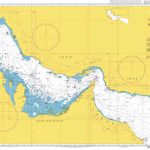
 Admiralty Chart 3409 – Plans in Iran, Oman and the United Arab Emirates
 United Arab Emirates: Architectural Guide
 Oman & Yemen ITMB
 Keepers of the Golden Shore: A History of the United Arab Emirates
 United Arab Emirates
 Yemen – Gulf of Aden Wall Map
 Flag of United Arab Emirates
 United Arab Emirates – Culture Smart!
 Oman Reise Know-How
 United Arab Emirates Marco Polo Guide
 Egypt Wall Map
 Saudi Arabia Wall Map
 Admiralty Chart 2858 – Gulf of Oman to Shatt al `Arab
 Admiralty Chart 3413 – Oil and Gas Terminals in Qatar and the United Arab Emirates
 Dhofar Road Map – Salalah and Southern Oman
 Algeria Road Edition Wall Map
 Morocco Wall Map
 Algeria Geographical Wall Map
 Egypt Gizi Map
 Red Sea Wall Map
 Mauritania Wall Map
 Saudi Arabia Gizi Map
 Middle East Wall Map
 Saudi Arabia F&B
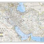
 Iran Wall Map
 Iran NGS Classic Wall Map PAPER
 Libya Geographical Edition Wall Map
 Algeria (Road Edition)
 Libya Road Edition Wall Map
Turkmenistan Gizi Wall Map
Libya Road Edition Wall Map
Turkmenistan Gizi Wall Map
 Saudi Arabia & Kuwait ITMB
 Morocco Gizi Map
 NGA Chart 62028 – Gulf of Oman and Adjacent Coasts – Karachi to Jazirat Masirah
 Algeria Gizi Geographical Map
 China Gizi Map Geographical Wall Map
 Oman Bradt Guide
 Somalia Wall Map
 Uzbekistan Gizi Map Wall Map