Disclosure : This site contains affiliate links to products. We may receive a commission for purchases made through these links.
Olot – Garrotxa NP Volcanic Zone

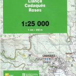
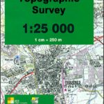
Topographic survey of Catalonia at 1:25,000 from the Institut Cartogrร fic i Geolรฒgic de Catalunya, an attractive alternative to Spain’s national topographic survey at this scale, offering a much larger area per sheet with extensive tourist information and vivid presentation of vegetation and land use.These large, detailed maps have contours at 10m intervals enhanced by hill shading and fine colouring and/or graphics to portray of vegetation or land use (different types of woodlands, marshland, vineyards, crops, etc). An overprint highlights waymarked local and long-distance GR footpaths plus CT cycling routes. Also highlighted are picturesque locations such as villages, isolated buildings or natural features. A very wide range of symbols indicate various facilities, places of interest and recreational sites: tourist information centres, campsites and other rural accommodation, cultural heritage, vineries, wildlife observation areas, viewpoints and beauty spots, sites for recreational pursuits including horse riding, water sports, paragliding, etcThe maps are divided by the publishers into three types: Administrative Units, Natural Protected Areas, and Geographical Areas, as shown on our grid for this series. Coverage by each sheet varies; most maps present an area of 30 x 23km (19 x 14km approx). The maps have a 1km UTM grid, with latitude and longitude values shown for the map corners. Excellently presented topographic map legend is in Catalan only but the legend for the tourist information and the road network includes English.To see the list of all the titles in this series please click on the series link.

Related Products:
 Alta Garrotxa – la Muga
L`Albera Natural Park
Alta Garrotxa – la Muga
L`Albera Natural Park
 Cap de Creus Natural Park
Girona
Tortosa
Cap de Creus Natural Park
Girona
Tortosa
 Falset
 Delta de l`Ebre Parc Natural
Mรณra d`Ebre
Delta de l`Ebre Parc Natural
Mรณra d`Ebre
 Figueres – Aiguamolls dels Empordร Natural Park
 El Pont de Suert
Baixa Ribagorรงa
Pla de la Llitera – Riu de Farfanya
Les Borges Blanques
Lleida – Pla de Raimat
Manresa – Pla de Bages
El Pont de Suert
Baixa Ribagorรงa
Pla de la Llitera – Riu de Farfanya
Les Borges Blanques
Lleida – Pla de Raimat
Manresa – Pla de Bages
 La Bisbal d`Emporda
Els Ports Natural Park: Vall-de-roures – Arnes
La Seu d’Urgell – PN de l’Alt Pirineu
Vall de Nรบria ‘“ Ulldeter
Tร rrega – Plana d`Urgell
Cadรญ-Moixerรณ Natural Park East: el Moixerรณ – Tรบnel del Cadรญ
Alt Cardener – el Port del Comte
Fraga – Baix Segre
Banyoles – Besalu – Rocacorba
Cadรญ-Moixerรณ Natural Park West: la Seu d’Urgell – Vall de la Vansa
Spain: 25K Catalan Topographic Survey
Organyร -Boumort – Serra de Taรบs
Vall de la Llosa – el Baridร
La Bisbal d`Emporda
Els Ports Natural Park: Vall-de-roures – Arnes
La Seu d’Urgell – PN de l’Alt Pirineu
Vall de Nรบria ‘“ Ulldeter
Tร rrega – Plana d`Urgell
Cadรญ-Moixerรณ Natural Park East: el Moixerรณ – Tรบnel del Cadรญ
Alt Cardener – el Port del Comte
Fraga – Baix Segre
Banyoles – Besalu – Rocacorba
Cadรญ-Moixerรณ Natural Park West: la Seu d’Urgell – Vall de la Vansa
Spain: 25K Catalan Topographic Survey
Organyร -Boumort – Serra de Taรบs
Vall de la Llosa – el Baridร
 Sort – PN de l`Alt Pirineu Sud
Montsec de Rรบbies – Vall de Barcedana
Amposta – Pla de la Galera – Montsiร – Riu de la Sรฉnia
Puigcerda Llavia la Tossa d`Alp
Oliana – del Rialb a la Ribera Salada
Flix – Riba-roja d`Ebre
Ripoll – Sant Joan de les Abadesses
Costa Brava Central: les Gavarres
Sort – PN de l`Alt Pirineu Sud
Montsec de Rรบbies – Vall de Barcedana
Amposta – Pla de la Galera – Montsiร – Riu de la Sรฉnia
Puigcerda Llavia la Tossa d`Alp
Oliana – del Rialb a la Ribera Salada
Flix – Riba-roja d`Ebre
Ripoll – Sant Joan de les Abadesses
Costa Brava Central: les Gavarres
 Alt Pirineu Natural Park NE: Pica d’Estats – Vall de Cardos – Vall Ferrera
Montsec d’Ares – Congost de Mont-rebei
Alt Pirineu Natural Park NE: Pica d’Estats – Vall de Cardos – Vall Ferrera
Montsec d’Ares – Congost de Mont-rebei
 Santa Coloma de Farners – Plana de la Selva
Balaguer – el Monestir d`Avellanes – Camarasa – Ribera de Siรณ
Santa Coloma de Farners – Plana de la Selva
Balaguer – el Monestir d`Avellanes – Camarasa – Ribera de Siรณ