Disclosure : This site contains affiliate links to products. We may receive a commission for purchases made through these links.
Categories
-
Best Sellers
-

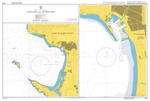
Admiralty Chart 1938 – Ensenada and Approaches Bahia de Todos Santos
Admiralty standard nautical charts comply with Safety of Life at Sea (SOLAS) regulations and are ideal for professional, commercial and recreational use. Charts within the series Read More » -

Admiralty Chart PNG522 – North East Coast, Cape Ward Hunt to Nassau Bay
NEW EDITION OUT ON 29/10/2020Admiralty standard nautical charts comply with Safety of Life at Sea (SOLAS) regulations and are ideal for professional, commercial and recreational use. Read More » -

Arequipa Tourist Plan
A combined street plan and road map of the Arequipa region, with bilingual notes for tourists. The main map (scale unspecified) presents an oblique view of Read More » -

The Melting
`Challenging and disturbing, The Melting is an incredibly cruel fable about friendship and adolescence . . . Spit knows no fear. It is we, the readers, Read More » -

First Illustrated English Dictionary
A perfect first dictionary for children in their first years of school, with over 500 colourful illustrations and definitions of over 2,500 words written in simple, Read More » -
Tashkent
Tashkent region at 1:500,000 in a series of detailed, contoured maps of the mountains of Central Asia derived from the Soviet era topographic survey but with Read More » -

NGA Chart 57082 – Port of Tema
Produced by the US Government, National Geospatial-Intelligence Agency (NGA) charts provide information for the International Waters. They are printed on demand at our London shop and Read More » -

Geological wonders of Namibia
A beautiful depiction (with explanations) of geology in Namibia, from impact crater sites, meteorites, canyons and limestone caves to vast desert landscapes, moonscapes and bizarrely-shaped rocks, Read More » -

La Libertad
One of the titles in a series of maps of the administrative departments of Peru, with topography shown by altitude colouring and spot heights. Most maps Read More » -

India East Nelles
Eastern India at 1:1,500,000 in a series of double-sided maps from Nelles, with their slightly smaller size offering a convenient format for use when travelling. The Read More »
-


