Disclosure : This site contains affiliate links to products. We may receive a commission for purchases made through these links.
Oahu, Honolulu & Big Island ITMB
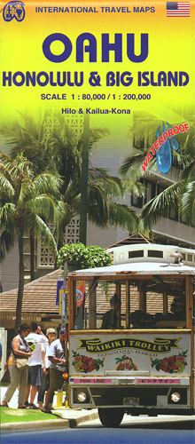
Oahu at 1:80,000 with a street plan of Honolulu from the Pearl Harbour to the Waikiki Beach and the Diamond Head Crater, plus the Big island at 1:200,00 with plans of Hilo and Kailua-Kona on a waterproof and tear-resistant, double-side map from ITMB. Topography of the two islands is vividly presented by altitude colouring with numerous spot heights (both in feet); on the Big Island numerous crates are highlighted. The network of roads and local tracks indicates routes practical only for 4WD vehicles and shows locations of petrol stations. Symbols highlight various places of interest and tourist facilities, including botanical gardens and nature reserves, hot springs and waterfalls, historic sites, etc. Latitude and longitude are shown by lines at 0.4ยบon Oahu and 0.2ยบon the Big Island. Each island has a separate index and brief descriptions of various sights.The map of Oahu clearly indicates which area is covered by the plan of Honolulu at 1:35,000 which extends along the coast to both sides of the downtown area: to the Honolulu International Airport and beyond it to the historic monuments in Pearl Harbour, and south-west to the Waikiki district and the Diamond Head Crater. Plans of Hilo and Kailua-Kona are at 1:30,000 and, like the Honolulu plan, highlight hotels and other tourist accommodation, shopping centres, etc.To see other regional titles from ITMB covering USA please click on the series link.


