Disclosure : This site contains affiliate links to products. We may receive a commission for purchases made through these links.
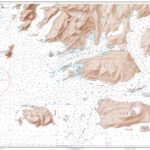
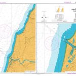
NZ614 Tasman Bay / Te Tai-o-Aorere
Plans included:Port Motueka 1:20,000Mapua 1:20,000Nautical charts for New Zealand, created by Land Information New Zealand (LINZ), are printed on demand at Stanfords after your order is placed and processed. They provide a detailed coverage of the coastline with a varied range of scales – from overall route planning to detailed harbour charts.Notices to Mariners are available via this link.Source: Land Information New Zealand (LINZ) and licensed by LINZ for re-use under the Creative Commons Attribution 4.0 International licence.

Related Products:
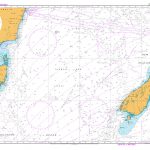 NZ14601 Tasman Sea, New Zealand to S.E. Australia
 NZ6144 Abel Tasman
 NZ5111 Plans between Parengarenga and Whangaruru
 NZ5322 Auckland Harbour East
NZ6142 Nelson Harbour and Entrance
NZ5322 Auckland Harbour East
NZ6142 Nelson Harbour and Entrance
 NZ4634 Wellington Harbour Entrance and Plans of Wharves
 NZ6612 Otago Harbour
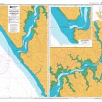 NZ4212 Hokianga Harbour
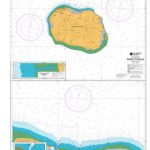
 NZ2865 Plans in the Chatham Islands
 NZ4421 Raglan Harbour (Whaingaroa)
 NZ5323 Auckland Harbour West
 NZ5113 Plans in Rangaunu Bay
 NZ2862 Plans in the Auckland Islands
 NZ7142 Greymouth Harbour and Approaches
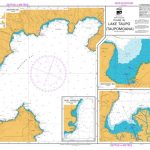 NZ2325 Plans in Lake Taupo (Taupomoana)
 NZ5212 Plans between Whangamumu and Omaha Cove
 NZ861 Plans in Samoa
 NZ4423 Kawhia Harbour
 NZ5328 Coromandel Harbour
 NZ5316 Whitianga Harbour
 NZ4633 Wellington Harbour
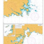
NZ5125 Bay of Islands
NZ4633 Wellington Harbour
NZ5125 Bay of Islands
 NZ9558 Rarotonga
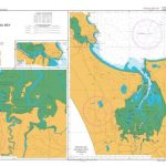
 NZ43 Manukau Harbour to Cape Egmont
NZ5215 Whangarei Harbour
New Zealand Charts for North Island
New Zealand Charts for Pacific Islands
NZ6321 Lyttelton Harbour / Whakaraupo
NZ43 Manukau Harbour to Cape Egmont
NZ5215 Whangarei Harbour
New Zealand Charts for North Island
New Zealand Charts for Pacific Islands
NZ6321 Lyttelton Harbour / Whakaraupo
 NZ6821 Bluff Harbour and Entrance
 NZ6912 Plans in Stewart Island / Rakiura
 NZ6154 Tory Channel Entrance and Picton Harbour
 NZ8215 Niuatoputapu Group and Niuafo`ou
 NZ5124 Plans in the Bay of Islands
 NZ6324 Akaroa Harbour
NZ4314 Manukau Harbour
NZ6324 Akaroa Harbour
NZ4314 Manukau Harbour
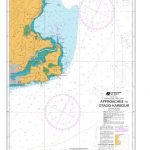
 NZ8275 Approaches to Nuku`alofa Harbour
 NZ4632 Approaches to Porirua Harbour
 NZ661 Approaches to Otago Harbour
NZ2867 Pitt Strait
NZ2687 Pitt Strait
NZ661 Approaches to Otago Harbour
NZ2867 Pitt Strait
NZ2687 Pitt Strait