Disclosure : This site contains affiliate links to products. We may receive a commission for purchases made through these links.
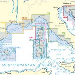
NV Charts – Mediterranean Spain Chart Atlases

Related Products:
 NV Charts – Croatia and Montenegro Chart Atlases
 NV Charts Inland Waterways Atlases
 Spain`s Sendero Historico: The GR1: Northern Spain – Picos to the Mediterranean
 Admiralty Chart Folio 25 – Mediterranean Coasts of Spain and France, Strait of Gibraltar to San Remo, incl. Balearic Islands, Corsica and Sardinia
 Imray-Tetra Charts: The Mediterranean
 SHOM Charts for the Black Sea – Marmara Sea – Mediterranean Sea
 SHOM Charts for Spain – Portugal – The Strait of Gibraltar – The Alboran Sea
 SHOM Charts for the East Coast of Spain – Balearic Islands
 RCC Mediterranean Spain
 SHOM Charts for the North East Atlantic, North Sea, Baltic Sea, Mediterranean Sea
 Coastline: The food of Mediterranean Italy, France and Spain
 SHOM Charts for the South West Coast of France – North Coast of Spain
 Chart Atlases for the Netherlands
 Chart Atlases for Germany
 Chart Atlases for the Baltic Sea
 Chart Atlases for France
 Chart Atlases for Norway
 Chart Atlases for English South Coast
 NOAA Charts for Alaska Coast (Planning Charts)
 Spain: Tienda Verde Hiking Maps of Central Spain
 Spain: 50K Mainland Spain Civilian Topographic Survey
 Spain: 25K Mainland Spain Civilian Topographic Survey
 Spain: Sua Edizioak Map/Guides of the Pyrenees and Northern Spain
 Admiralty Chart 4004 – A Planning Chart for the North Atlantic Ocean and Mediterranean Sea
 Admiralty Chart Folio 30 – Eastern Mediterranean ‘“ Rhodes to El Arish incl. Cyprus
 Admiralty Chart Folio 18 – West Coast of Spain, Portugal, Strait of Gibraltar
 Imray Chart A233: Virgin Islands Double-sided sheet combining charts A231 and A232: 2019
 Mediterranean Sea Chart-Guides Italy 3
 Mediterranean Sea Chart-Guides Italy & Corsica 2
 Maritime Security Chart Q6110 – Mediterranean Sea
 Admiralty Chart 4300 – Mediterranean Sea and Black Sea
 Wild Swimming Spain: Discover the Most Beautiful Rivers, Lakes and Waterfalls of Spain
 Admiralty Routeing Chart 5146(1) – Mediterranean and Black Seas Routeing Chart – January
 Admiralty Routeing Chart 5146(2) – Mediterranean and Black Seas Routeing Chart – February
 Admiralty Routeing Chart 5146(3) – Mediterranean and Black Seas Routeing Chart – March
 Admiralty Routeing Chart 5146(4) – Mediterranean and Black Seas Routeing Chart – April
 Admiralty Routeing Chart 5146(8) – Mediterranean and Black Seas Routeing Chart – August
 Admiralty Routeing Chart 5146(9) – Mediterranean and Black Seas Routeing Chart – September
 Admiralty Routeing Chart 5146(10) – Mediterranean and Black Seas Routeing Chart – October
 Admiralty Routeing Chart 5146(11) – Mediterranean and Black Seas Routeing Chart – November


