Disclosure : This site contains affiliate links to products. We may receive a commission for purchases made through these links.
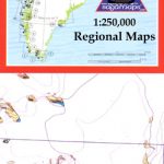
Nuuk – Ivittuut
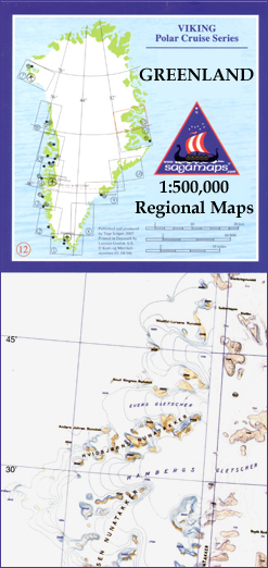
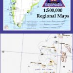
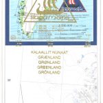
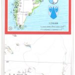
One of the titles in a series of contoured physical maps covering the coastal areas of Greenland. The maps have the same cartography as the 1:250,000 series by this publisher, reproduced here at half the original scale. The reduction means that some place names, symbols and fine detail are harder to read than on the original 1:250,000 series.Main peaks, bays, channels etc. are named, and settlements, airstrips, and anchorages are shown. Glaciers, moraine and low-lying coastal plains are also distinguished. Lines of longitude and latitude are drawn at 1ยฐ and 15` intervals respectively. There is no map legend.

Related Products:
 Kangerlussuaq – Nuuk
Upernavik
Qaanaaq – Thule
Qeqertarsuup Tunua
Saqqisikuik – Skjoldungen
Tasilaq – Angmagssalik
Kalaallit Nunaata Kujataa
Qeqertarsuup Tunua – Kangerlussuaq
Kangerlussuaq – Nuuk
Upernavik
Qaanaaq – Thule
Qeqertarsuup Tunua
Saqqisikuik – Skjoldungen
Tasilaq – Angmagssalik
Kalaallit Nunaata Kujataa
Qeqertarsuup Tunua – Kangerlussuaq
 Qeqertarsuatsiaat – Paamiut – Ivittuut Special Map
 Kangertittivaq – Scoresbysund Fjord 11
Nuuk – Godthรฅb
Kangerlussuaq – Gunnbjรธrns Fjeld – Hvitserk (10)
Nuuk – Godthรฅb Historical Map
Napasoq – Nuuk – Qeqertarsuatsiaat Special Map
Kejser Franz Joseph Fjord – Ella ร-Daneborg
Disko Bay
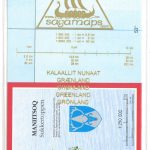
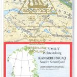
Sisimiut – Kangerlussuaq – Maniitsoq
Kangertittivaq – Scoresbysund Fjord 11
Nuuk – Godthรฅb
Kangerlussuaq – Gunnbjรธrns Fjeld – Hvitserk (10)
Nuuk – Godthรฅb Historical Map
Napasoq – Nuuk – Qeqertarsuatsiaat Special Map
Kejser Franz Joseph Fjord – Ella ร-Daneborg
Disko Bay
Sisimiut – Kangerlussuaq – Maniitsoq
 Greenland Red Set 1-4
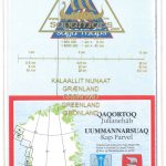 Qaqortoq – Julianehab
Ivituut – Ivigtut
Narsarsuaq – Narssarssuaq
Paamiut – Frederikshab
Kangerluarsoruseq – Faeringehavn
Qaqortoq – Julianehab
Ivituut – Ivigtut
Narsarsuaq – Narssarssuaq
Paamiut – Frederikshab
Kangerluarsoruseq – Faeringehavn
 Maniitsoq – Sukkertoppen
 Sisimiut – Holsteinsborg
Kangaatsiaq – Kangatsiaq
Nuussuaq – Nugssuaq
Sisimiut – Holsteinsborg
Kangaatsiaq – Kangatsiaq
Nuussuaq – Nugssuaq
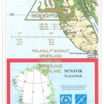 Nunavik – Svartenhuk
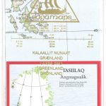 Tasiilaq – Angmassalik
 Ittoqqortoormiit – Scoresbysund
 Ilimananngip – Milneland
Greenland Yellow Set 9-12
Tasiilak Historical Map
Ilimananngip – Milneland
Greenland Yellow Set 9-12
Tasiilak Historical Map
 Greenland Orange Set 5-8
Greenland Green Set 13-16
Greenland Blue Set 17-20
Qeqertarsuak – Disko ร
Pituffik – Thule Air Base
Qimusseriarsuaq – Melville Bugt
Greenland: Saga 500K/370K Maps
Greenland Orange Set 5-8
Greenland Green Set 13-16
Greenland Blue Set 17-20
Qeqertarsuak – Disko ร
Pituffik – Thule Air Base
Qimusseriarsuaq – Melville Bugt
Greenland: Saga 500K/370K Maps