Disclosure : This site contains affiliate links to products. We may receive a commission for purchases made through these links.
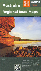
Nullarbor Plain Eastern Sheet – Border Village to Port Pirie Hems Explorer Map
Related Products:
 Nullarbor Plain Western Sheet – Kalgoorlie to Border Village Hema Explorer Map
 Admiralty Chart AUS136 – Approaches to Whyalla and Port Pirie
 Across the Blight & Nullarbor: Port Augusta (SA) to Esperance (WA) Moon Adventure Publications Guide
 Islay North: Port Askaig, Bridgend & Port Charlotte OS Explorer Map 353 (paper)
 Islay North – Port Askaig, Bridgend & Port Charlotte OS Explorer Active Map 353 (waterproof)
 Brades Village 1913: Staffordshire sheet 68.13b
 Brecon Beacons Eastern OS Explorer Map OL13 (paper)
 Admiralty Chart 2250 – Orkney Islands Eastern Sheet
 North York Moors Eastern OS Explorer Map OL27 (paper)
 Brecon Beacons Eastern OS Explorer Active Map OL13 (waterproof)
 Admiralty Chart AUS309 – Darwin to Penguin Shoal (Eastern Sheet)
 North York Moors Eastern OS Explorer Active Map OL27 (waterproof)
 Admiralty Chart AUS324 – Lacepede Islands to Bedout Islet (Eastern Sheet)
 The Village: 400 Years of Beats and Bohemians, Radicals and Rogues, a History of Greenwich Village
 Swansea – Neath & Port Talbot OS Explorer Map 165 (paper)
 Admiralty Chart AUS25 – Port Darwin (Northern Sheet)
 Admiralty Chart AUS26 – Port Darwin (Southern Sheet)
 Swansea – Neath & Port Talbot OS Explorer Active Map 165 (wateproof)
 Islay South: Port Ellen, Bowmore & Bridgend OS Explorer Map 352 (paper)
 Newquay & Padstow – Wadebridge, Port Isaac & St Columb Major OS Explorer Map 106 (paper)
 Islay South: Port Ellen, Bowmore & Bridgend OS Explorer Active Map 352 (waterproof)
 Admiralty Chart 8285 – Johor Strait, Eastern Part Port Approach Guide
 Newquay & Padstow – Wadebridge, Port Isaac & St Columb Major OS Explorer Active Map 106 (waterproof)
 The English Lakes – North-Eastern Area – Penrith, Patterdale & Caldbeck OS Explorer OL5
 The English Lakes – South-Eastern Area – Windermere, Kendal & Silverdale OS Explorer OL7
 The English Lakes – North-Eastern Area – Penrith, Patterdale & Caldbeck OS Explorer OL5 ACTIVE
 The English Lakes – South-Eastern Area – Windermere, Kendal & Silverdale OS Explorer OL7 ACTIVE
 Admiralty Chart 666 – Port Mombasa including Port Kilindini and Port Reitz
 Wild Coast: East London – Port St Johns – Port Edward
 NOAA Chart 11312 – Corpus Christi Bay’”Port Aransas to Port Ingleside – Port Ingleside
 Leadhills: Brief Sheet Explanation for 1: 50 000 Scale Geology Map, Sheet S15e (Scotland)
 US / Mexico Border ITMB
 US/Canada Border ITMB
 Dulwich Village 1913
 Wallasey Village 1898
 Brades Village 1902 68.13a
 Dulwich Village 1894
 Ryhope Village 1895
 San Diego & USA South West Border ITMB
 Mill Hill Village 1898


