Disclosure : This site contains affiliate links to products. We may receive a commission for purchases made through these links.
Categories
-
Best Sellers
-

Winterthur – Tรถsstal
Winterthur ‘“ Tรถsstal area at 1:50,000 in a series from Hallwag covering Switzerland’s popular hiking regions on light, waterproof and tear-resistant maps highlighting long-distance paths: the Read More » -

Expedition to the Zambesi
David Livingstone, immortalised for generations of armchair adventurers in Henry Stanley`s question `Dr Livingstone, I presume!`, was one of the most intrepid and daring explorers of Read More » -

Shadowscent: The Darkest Bloom
A sensational debut fantasy adventure!In the empire of Aramtesh, scent has power. When disaster strikes and the crown prince lies poisoned, long-suppressed rivalries threaten to blow Read More » -

A Little Bit Brave
Logan is a stay-at-home bunny – but he`s about to discover how brave he really is. It`s time for his first adventure, and he doesn`t want Read More » -

Beat about the Bush
Mammals are the animals that most people come to wilderness areas to see. They range in size from the pygmy shrew (2g) to the blue whale Read More » -

Tortoise 1-5 Jigsaw
A chunky, colourful five piece jigsaw perfect for learning through play. Little ones can learn to count as they slot puzzle pieces together to create a Read More » -

Copenhagen Borch
Excellent laminated and waterproof map for visitors to Copenhagen, combining a plan of the city with a map of its outer suburbs and a map of Read More » -

Waterkaart 5 Kop Overijssel / Gelderse
Folded chart of the Dutch waterway area Kop Overijssel/Gelderse, published by ANWB. New editions published every year.ANWB also publish the ANWB Almanak Deel 1 2019/2020 which Read More » -
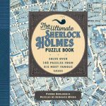
The Ultimate Sherlock Holmes Puzzle Book: Solve Over 140 Puzzles from His Most Famous Cases
Solve over 144 puzzles, navigate around maps of London and the English countryside, search for hidden clues, and-most importantly-exercise your sharp intellect and keen perception skills, Read More » -
Admiralty Routeing Chart 5127(3) – N Pacific – March
Essential for use in passage planning for ocean voyages, Routeing Charts include routes and distances between major ports, ocean currents, ice limits, load lines and wind Read More »
-


