Disclosure : This site contains affiliate links to products. We may receive a commission for purchases made through these links.
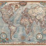
Nova Orbis Tabula, Mapamundi Wall Map, c. 1670
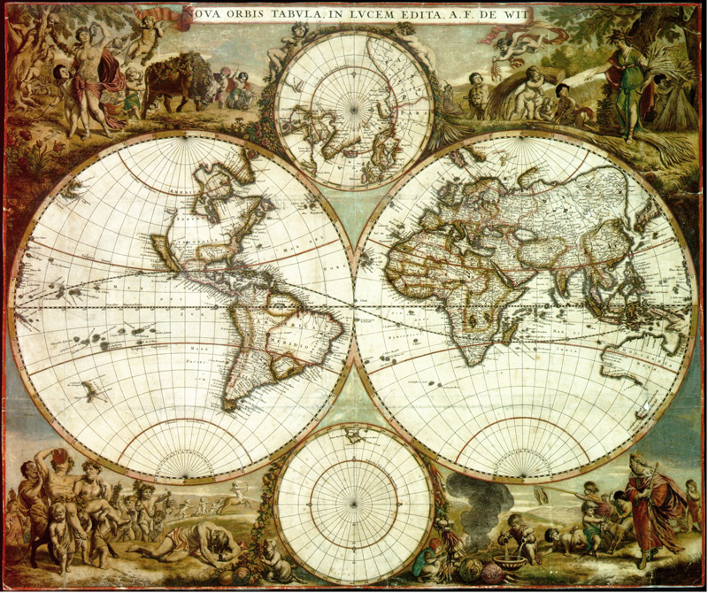
A reproduction of a very pretty wall map of the world from mid-17th century, size 62x53cm /(24.5″x21″ approx), with the two hemispheres accompanied by circular insets showing the Polar Regions and surrounded by colourful drawings.Drawn by Frederick de Wit (1629/1630 ‘“ 1706) and originally published in Amsterdam around 1665, the map is not dated but Australia is annotated as ‘Detecta 1644″. The map provides a fascinating picture of the extent of geographical knowledge in mid-17th century: quite accurate presentation of the coastlines of Africa or South America but not much was known then about western North America and eastern Australia is still blank. Equally contrasting are the two insets of the Polar Region, already much of the Arctic is shown but nothing around the ‘Polus Antarcticus”. Lovely colourful drawings surrounding the map present a very jolly picture of the world full of wine and happy cherubs!

Related Products:
 South Africa De Long Wine Wall Map
 South Africa De Long Wine Map
 South America De Long Wine Wall Map
 South America De Long Wine Map
 Australia De Long Wine Wall Map
 Australia Wine Map
 World NGS Decorator Wall Map PAPER
 World NGS Decorator Wall Map LARGE PAPER
 World Michelin Wall Map PAPER
 World Michelin Wall Map PIN-BOARD FRAMED
 Germany De Long Wine Wall Map
 World: National Geographic Society Decorator Style Political Wall Maps
 The World – The National Geographic 125th Anniversary Wall Map PAPER
 World NGS Decorator Wall Map ENCAPSULATED
 World NGS Decorator Wall Map LARGE ENCAPSULATED
World Michelin Wall Map MAGNETIC-BOARD FRAMED
World NGS Decorator Wall Map LARGE ENCAPSULATED
World Michelin Wall Map MAGNETIC-BOARD FRAMED
 Australia De Long Wine Map
World: Michelin Political Wall Maps
Australia De Long Wine Map
World: Michelin Political Wall Maps
 World F&B Political Wall Map MEDIUM
 Stanford`s Library Map of the World (1879) – A3 Wall Map, Paper
Stanford`s Library Map of the World (1879) – A3 Wall Map, Canvas
Stanford`s Library Map of the World (1879) – A2 Wall Map, Canvas
Stanford`s Library Map of the World (1879) – A1 Wall Map, Canvas
Stanford`s Library Map of the World (1879) – A3 Wall Map, Paper
Stanford`s Library Map of the World (1879) – A3 Wall Map, Canvas
Stanford`s Library Map of the World (1879) – A2 Wall Map, Canvas
Stanford`s Library Map of the World (1879) – A1 Wall Map, Canvas
 World F&B Political Wall Map MEDIUM – with Metal Hanging Strips
 Stanford`s Library Map of the World (1879) – Original Size Wall Map, Paper
 Stanford`s Library Map of the World (1879) – Original Size Wall Map, Canvas
Stanford`s Library Map of the World (1879) – A2 Wall Map, Paper – Print on Demand
Stanford`s Library Map of the World (1879) – A1 Wall Map, Paper – Print on Demand
Stanford`s Library Map of the World (1879) – Original Size Wall Map, Canvas
Stanford`s Library Map of the World (1879) – A2 Wall Map, Paper – Print on Demand
Stanford`s Library Map of the World (1879) – A1 Wall Map, Paper – Print on Demand
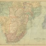 Stanford`s Map of British South Africa (1894) – A3 Wall Map, Paper
Stanford`s Map of British South Africa (1894) – A3 Wall Map, Canvas
Stanford`s Map of British South Africa (1894) – A2 Wall Map, Paper
Stanford`s Map of British South Africa (1894) – A2 Wall Map, Canvas
Stanford`s Map of British South Africa (1894) – A1 Wall Map, Paper
Stanford`s Map of British South Africa (1894) – A1 Wall Map, Canvas
Stanford`s Map of British South Africa (1894) – A3 Wall Map, Paper
Stanford`s Map of British South Africa (1894) – A3 Wall Map, Canvas
Stanford`s Map of British South Africa (1894) – A2 Wall Map, Paper
Stanford`s Map of British South Africa (1894) – A2 Wall Map, Canvas
Stanford`s Map of British South Africa (1894) – A1 Wall Map, Paper
Stanford`s Map of British South Africa (1894) – A1 Wall Map, Canvas
 The World – The National Geographic 125th Anniversary Wall Map ENCAPSULATED
 World Executive Ray & Co Wall Map ENCAPSULATED
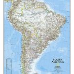 South America NGS Classic Wall Map PAPER
 Stanford`s South Polar Chart (1901) – A2 Wall Map, Paper
Stanford`s South Polar Chart (1901) – A2 Wall Map, Canvas
Stanford`s South Polar Chart (1901) – A1 Wall Map, Canvas
Stanford`s South Polar Chart (1901) – A2 Wall Map, Paper
Stanford`s South Polar Chart (1901) – A2 Wall Map, Canvas
Stanford`s South Polar Chart (1901) – A1 Wall Map, Canvas