Disclosure : This site contains affiliate links to products. We may receive a commission for purchases made through these links.
Nottinghamshire Philip`s Street Atlas
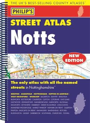
THE ONLY COUNTY STREET ATLAS WITH ALL THE NAMED STREETS OF NOTTINGHAMSHIREThe UK`s best-selling county street atlasesMore than 24,000 named streets, roads, lanes and alleysThe essential map book for residents and visitors – and if you`re moving to NottinghamshireIncludes all the streets in BEESTON, MANSFIELD, NOTTINGHAM, SUTTON IN ASHFIELD, WEST BRIDGFORD, WORKSOP, Balderton, Bawtry, Bingham, Blidworth, Bottesford, Calverton, Clifton, Cotgrave, East Leake, Eastwood, Edwinstowe, Gainsborough, Harworth, Hucknall, Kegworth, Keyworth, Kimberley, Kirkby in Ashfield, Long Eaton, Mansfield Woodhouse, Market Warsop, Newark-on-Trent, Ollerton, Pinxton, Radcliffe on Trent, Rainworth, Ravenshead, Retford, Ruddington, Saxilby, Shirebrook, Southwell, Stapleford, Tickwell. – New edition in practical spiral-bound format- Street maps show car parks, schools, hospitals and many other places of interest, even ones off the beaten path- 4-page practical route-planning section showing all A and B roads- Super-clear mapping- Easy-to-use index- Scales: 13/4 inches to 1 mile (1:36,000) and 31/2 inches to 1 mile (1:18,000). Major towns: 7 inches to 1 mile (1:9,000).Other information on the maps includes postcode boundaries, car parks, railway and bus stations, post offices, schools, colleges, hospitals, police and fire stations, places of worship, leisure centres, footpaths and bridleways, camping and caravan sites, golf courses, and many other places of interest.

Related Products:
 Buckinghamshire and Milton Keynes Philip`s Street Atlas
 Norfolk Philip`s Street Atlas
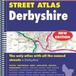 Derbyshire Philip`s Street Atlas
 Devon Philip`s Street Atlas
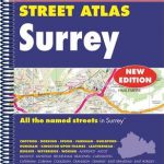 Surrey Philip`s Street Atlas
 London Philip`s Mini Street Atlas
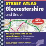 Gloucestershire Philip`s Street Atlas
 Cornwall Philip`s Street Atlas
 Dorset Philip`s Street Atlas
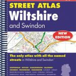 Wiltshire and Swindon Philip`s Street Atlas
 London Philip`s Street Atlas De Luxe Edition Union Jack
 Mansfield – Kirkby-in-Ashfield – Sutton-in-Ashfield A-Z Street Atlas
 Leicestershire and Rutland Philip`s Street Atlas
 Nottinghamshire A-Z County Street Atlas
 Burton upon Trent – Ashby-de-la-Zouch – Coalville – Swadlincote A-Z Street Atlas
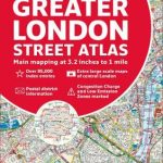 Greater London Collins Street Atlas
 London A-Z Big Street Atlas
 Nottingham A-Z Street Atlas
 Aberdeen A-Z Street Atlas
 Bolton – Bury A-Z Street Atlas
 Canterbury, Margate, Ramsgate & North Kent Coastal Towns A-Z Street Atlas
 Bristol – Bath A-Z Street Atlas
 Bath – Bradford-on-Avon – Trowbridge A-Z Street Atlas
 Kingston upon Hull – Barton-upon-Humber – Beverley A-Z Street Atlas
 Croydon – Purley – Sutton – Mitcham A-Z Street Atlas
 Bournemouth – Poole – Christchurch A-Z Street Atlas
 Bangor – Conwy – Rhyl – Colwyn Bay – Llandudno A-Z Street Atlas
 Isle of Wight A-Z Street Atlas
 Dartford – Gravesend A-Z Street Atlas
 Blackburn – Accrington – Burnley A-Z Street Atlas
 Glasgow – Hamilton – Motherwell – Paisley A-Z Street Atlas
 Weymouth – Dorchester A-Z Street Atlas
 Manchester A-Z Big Street Atlas SPIRAL-BOUND
 Hastings – Bexhill – St. Leonards – Rye A-Z Street Atlas
 West Sussex A-Z Street Atlas
 Surrey A-Z Street Atlas
 Chelmsford – Braintree – Maldon – Witham A-Z Street Atlas
 Southport – Formby – Ormskirk – Skelmersdale A-Z Street Atlas
 Huddersfield – Batley – Cleckheaton – Dewsbury – Mirfield A-Z Street Atlas
 Southampton – Portsmouth A-Z Street Atlas