Disclosure : This site contains affiliate links to products. We may receive a commission for purchases made through these links.
Nottingham (Arnold & Daybrook) 1899 – 38.06

Nottingham Arnold and Daybrook in 1899 in a fascinating series of reproductions of old Ordnance Survey plans in the Alan Godfrey Editions, ideal for anyone interested in the history of their neighbourhood or family. The map covers Daybrook and part of Arnold north of Nottingham. Coverage runs from Front Street Arnold westward toSunrise Farm and Sunrise Hill, and from Redhill Farm southward to Daybrook station. Features include the Front Street and High Street area of Arnold, Arnot Hill, Home Brewery, GNR railway with Daybrook station, Daybrook Works, St Paul`s church, Cherryhill, White Hart pub, cemetery, Goodwood House, chapels, etc. On the reverse is an 1891 directory of Arnold. About the Alan Godfrey Editions of the 25″ OS Series:Selected towns in Great Britain and Ireland are covered by maps showing the extent of urban development in the last decades of the 19th and early 20th century. The plans have been taken from the Ordnance Survey mapping and reprinted at about 15 inches to one mile (1:4,340). On the reverse most maps have historical notes and many also include extracts from contemporary directories. Most maps cover about one mile (1.6kms) north/south, one and a half miles (2.4kms) across; adjoining sheets can be combined to provide wider coverage.FOR MORE INFORMATION AND A COMPLETE LIST OF ALL AVAILABLE TITLES PLEASE CLICK ON THE SERIES LINK.

Related Products:
 Nottingham (Sherwood) 1899 – 38.10
Central Nottingham 1899 – 42.02b
Nottingham (South) 1899 – 42.06b
Nottingham North 1913
Nottingham NW (New Basford & Hyson Green) 1913 – 38.13
Nottingham (Sherwood) 1899 – 38.10
Central Nottingham 1899 – 42.02b
Nottingham (South) 1899 – 42.06b
Nottingham North 1913
Nottingham NW (New Basford & Hyson Green) 1913 – 38.13
 Stockton (North) 1899 – 50.12a
 Ebbw Vale North 1899
Dumfries North 1899
Old Aberdeen 1899
Swindon (NW) 1899 – 15.03a
Swindon (NE) 1899 – 15.04a
Swindon South-West 1899
Swindon South-East 1899
Ebbw Vale North 1899
Dumfries North 1899
Old Aberdeen 1899
Swindon (NW) 1899 – 15.03a
Swindon (NE) 1899 – 15.04a
Swindon South-West 1899
Swindon South-East 1899
 Derby (South) 1899 – 50.13a
 Enfield (NW) 1911 – 7.02
 Tredegar North 1899
 Ebbw Vale (South) 1899 – 11.14
 New Tredegar 1899
Dumfries South 1899
Chester-le-Street 1895 – 13.09a
Alloa 1899
Aberdeen (Bridge of Don) 1899 – 75.03
March Station 1900
Axminster 1903 – 72.05
New Tredegar 1899
Dumfries South 1899
Chester-le-Street 1895 – 13.09a
Alloa 1899
Aberdeen (Bridge of Don) 1899 – 75.03
March Station 1900
Axminster 1903 – 72.05
 Hunmanby 1926
Pontnewynydd 1899
Worcester North-East 1902
Swanage 1900
Hunmanby 1926
Pontnewynydd 1899
Worcester North-East 1902
Swanage 1900
 Hayes 1907
 Nottingham A-Z Street Atlas
 Tredegar South 1899
 Walton on the Hill 1906
Brightlingsea 1895
Walton on the Hill 1906
Brightlingsea 1895
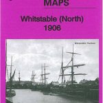 Whitstable (North) 1906 – 23.10
Glasgow High Street 1909
Glasgow High Street 1933
Whitstable (North) 1906 – 23.10
Glasgow High Street 1909
Glasgow High Street 1933
 Loughton (South) 1895 – 57.16
Griffin`s Hill 1902
Northfield North 1903
Houghton le Spring 1895
Loughton (South) 1895 – 57.16
Griffin`s Hill 1902
Northfield North 1903
Houghton le Spring 1895