Disclosure : This site contains affiliate links to products. We may receive a commission for purchases made through these links.
Norway Michelin
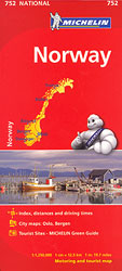
The Michelin National road map of Norway at 1:1,250,000 scale is ideal for route planning. The map gives comprehensive coverage of national road networks showing all major motorways, dual carriageways, national & regional main roads and some single-lane roads. Also shows unsurfaced roads and major footpaths. The map is divided by grid showing latitude and longitude.Distances between major locations are marked along roads, with total distance and several intermediate distances shown. A quick-reference chart of distances & driving times between major locations is also included. The map also includes a grid-referenced index of principal place names.Clear, easy-to read cartography shows roads in reds, yellows and white with black outlines. Major topography is indicated with relief shading. Woodland & forest is marked with green shading. Built-up urban areas are clearly marked in yellow. Airports, ferries and railways are also marked. National divisions are marked, as are areas restricted to foreigners and towns with tolls. Areas of interest such as churches, ruins and waterfalls are also displayed.Also includes a quick reference panel giving national driving regulations, including speed limits, equipment requirements (e.g. bulb kits, warning triangles) and seatbelt rules.Town plans & regional enlargements:- Oslo at 1:300,000 scale- Bergen at 1:300,000 scale

Related Products:
 Sweden Michelin
 Finland Michelin
 Austria Michelin
 Hungary Michelin
 Portugal – Madeira Michelin
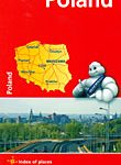 Poland Michelin
 Czechia Michelin
 Czechia – Slovakia Michelin
 Baltic States Michelin
 Czechia – Slovakia Michelin SUPERCEDED
 Slovenia – Croatia – Bosnia-Herzegovina – Serbia – Montenegro – North Macedonia Michelin
 Romania Michelin
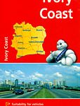 Ivory Coast Michelin
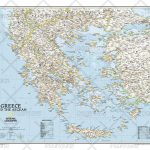
 Greece Michelin
 Latvia Regio Manors and Palaces
 Northern England – Midlands Michelin Regional 502
 Wales – South West England – Midlands Michelin Regional 503
 South East England – Midlands – East Anglia Michelin Regional 504
 Norway: Norstedts Regional Road Maps
 Poland: Michelin Regional Road Maps
 Norway Hallwag Road Map
 Southeastern USA Michelin Regional 584
 Germany – Benelux – Austria – Czechia Michelin
 Great Britain: Michelin 400K Road Maps
 Benelux Michelin
 Central Norway: Trondheim – Mo i Rana
 Central and North Norway: Bodรธ – Lofoten
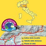 Italy: Michelin 200K Regional Road Maps
 Scotland Michelin Regional 501 WATERPROOF
 Scotland Michelin Regional 501
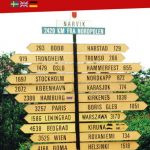
 North Norway: Narvik – Tromsรธ ‘“ Hammerfest – Vadsรธ
 Sicily Michelin Local 365
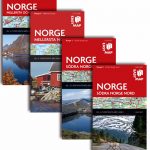
 Southern Norway North: Sognefjorden – Jotunheimen NP – Rondane NP – Trondheim
 Norway: Freytag & Berndt Regional Road Maps
 USA: Michelin Regional Road Maps
 Southern Norway South: Oslo – Stavanger – Bergen – Hardangervidda NP
 Lazio Michelin Local 360
 Calabria Michelin Local 364
 Piemonte – Aosta Valley Michelin Local 351