Disclosure : This site contains affiliate links to products. We may receive a commission for purchases made through these links.
Norway F&B Supertouring Road Atlas SPIRAL-BOUND

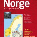
Norway at 1:400,000 on a glovebox size, spiral-bound road atlas from Freytag & Berndt, with street plans of the country’s six main cities, plus a touring atlas of Europe at 1:3,500,000 for route planning. Cartography is similar to the publishers’ series of regional road maps of Norway, but presents the whole country at the same scale of 1:400,000.Topography is indicated by unobtrusive relief shading and numerous spot heights, with colouring for forested areas. National parks are highlighted. Road network, graded into five types, highlights scenic routes, gives driving distances on most roads, and indicates motorway services. Railway lines and ferry connections are included and local airports are marked. Symbols indicate various places of interest, including campsites. The maps have no geographical coordinates. Map legend includes English.Also provided are street plans of central Oslo, Bergen, Hammerfest, Narvik, Stavanger and Trondheim, highlighting important buildings and main traffic arteries. In common with many road atlases from European publishers this title also includes a section covering the whole of Europe at 1:3,500,000 (northern Scandinavia and Finland at 1:10,000,000 only).

Related Products:
 Norway Road Atlas SPIRAL-BOUND
 Norway Cappelens Road Atlas A4 SPIRAL-BOUND
 Finland Road Atlas GLOVEBOX, SPIRAL-BOUND
 Alps – Northern Italy MairDumont Road Atlas SPIRAL-BOUND
 Europe Collins Essential Road Atlas 2021 A4 SPIRAL-BOUND
 Poland: Carta Blanca/Kompas Road Atlas 2015 GLOVEBOX, SPIRAL-BOUND
 Benelux – North France Michelin Road Atlas SPIRAL-BOUND
 Europe Philip`s Multiscale Road Atlas 2021 A4 SPIRAL-BOUND
Ukraine Road Atlas (500K, Spiral-bound)
Europe Philip`s Multiscale Road Atlas 2021 A4 SPIRAL-BOUND
Ukraine Road Atlas (500K, Spiral-bound)
 Finland Karttakeskus Motorbikers Road Atlas A5 SPIRAL-BOUND
 Europe Collins Essential Road Atlas A4 SPIRAL-BOUND
 USA Hema The Ultimate Road Atlas A3 SPIRAL-BOUND
 Hungary Pocket Road Atlas SPIRAL-BOUND
Italy F&B Great Road Atlas SPIRAL-BOUND
Hungary Pocket Road Atlas SPIRAL-BOUND
Italy F&B Great Road Atlas SPIRAL-BOUND
 USA – Southern Canada Marco Polo Road Atlas A4 SPIRAL-BOUND
 Hungary – Budapest Road Atlas SPIRAL-BOUND
 Britain & Ireland Philip`s Complete Road Atlas 2017 SPIRAL-BOUND
 Britain and Northern Ireland Collins Big Road Atlas 2022 A3 SPIRAL-BOUND
 Western Australia Hema Road & 4WD Track Atlas A4 SPIRAL-BOUND
 Great Britain A-Z Road Atlas 2022 A4 SPIRAL-BOUND
Britain and Northern Ireland Collins Big Road Atlas 2023 A3 SPIRAL-BOUND
Great Britain A-Z Road Atlas 2022 A4 SPIRAL-BOUND
Britain and Northern Ireland Collins Big Road Atlas 2023 A3 SPIRAL-BOUND
 Australia Hema Road & 4WD Touring Atlas A4 SPIRAL-BOUND
 Germany F&B Supertouring Atlas
 Australia Hema Road & 4WD Atlas SPIRAL-BOUND
 Australia UBD Gregory`s Road Atlas A4 SPIRAL-BOUND
 Great Britain & Northern Ireland A-Z Super Scale Road Atlas 2022 A3 SPIRAL-BOUND
 Britain Philip`s Navigator Trucker`s Road Atlas A3 SPIRAL-BOUND
 Australia Hema Road & 4WD Easy Read Atlas SPIRAL-BOUND
 New Zealand Kiwimaps Compact Travellers Atlas SPIRAL-BOUND
 France Philip`s Navigator Road Atlas SPIRAL-BOUND
 Britain Philip`s Navigator Road Atlas SPIRAL-BOUND
Britain and Northern Ireland Collins Essential Road Atlas 2022 A4 SPIRAL-BOUND
Britain Philip`s Navigator Road Atlas SPIRAL-BOUND
Britain and Northern Ireland Collins Essential Road Atlas 2022 A4 SPIRAL-BOUND
 USA NGS Adventure Edition Road Atlas A3 SPIRAL-BOUND
Great Britain A-Z Road Atlas 2023 A4 SPIRAL-BOUND
Britain and Ireland Collins Handy Road Atlas 2023 A5 SPIRAL-BOUND
USA NGS Adventure Edition Road Atlas A3 SPIRAL-BOUND
Great Britain A-Z Road Atlas 2023 A4 SPIRAL-BOUND
Britain and Ireland Collins Handy Road Atlas 2023 A5 SPIRAL-BOUND
 Britain and Ireland Collins Handy Road Atlas 2022 A5 SPIRAL-BOUND
 Britain and Ireland Collins Handy Road Atlas 2021 A5 SPIRAL-BOUND
 Trucker`s Britain Philip`s Road Atlas A3 SPIRAL-BOUND
 Britain Philip`s Big Easy to Read Road Atlas 2022 A3 SPIRAL-BOUND
 New Zealand Hema Touring Atlas A4 SPIRAL-BOUND