Disclosure : This site contains affiliate links to products. We may receive a commission for purchases made through these links.
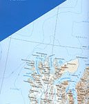
Norway: 500K Topographic Survey of Svalbard/Spitsbergen
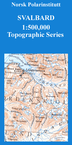
Topographic maps of the Svalbard (Spitsbergen) group from Norsk Polarinstitutt, with contours at 100m intervals. Physical features shown include moraine, rocks, coastline with flat foreshore, etc. The maps also show settlements, roads, mines, cabins, radio stations, aerial cableways, airfields, etc. National park and nature reserve boundaries are marked. The maps have a UTM grid and lines of longitude and latitude shown at 1ยฐ and 30` intervals respectively. Map legend includes English.

Related Products:
 Norway: 250K Topographic Survey of Svalbard/Spitsbergen
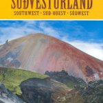
 Spitsbergen South
Spitsbergen North
Spitsbergen South
Spitsbergen North
 Norway: 100K Topographic Survey of Svalbard/Spitsbergen
Nordaustlandet
Edgeรธya
Norway: 100K Topographic Survey of Svalbard/Spitsbergen
Nordaustlandet
Edgeรธya
 Sweden: Lantmรคteriet 250K Topographic Survey
 Austria: 200K Topographic Survey Province Maps
Svalbard South-West
Austria: 200K Topographic Survey Province Maps
Svalbard South-West
 Svalbard Topographic Map
 Iceland: 250K Topographic Survey Road Maps
 Israel: 100K Topographic Survey Maps
Svalbard North
Svalbard South-East
Israel: 100K Topographic Survey Maps
Svalbard North
Svalbard South-East
 Sweden: Lantmรคteriet 100K Topographic Survey
 Svalbard North-East
Svalbard North-West
Svalbard North-East
Svalbard North-West
 Spitsbergen / Svalbard – Northern Norway ITMB
 Spain: 25K Mainland Spain Civilian Topographic Survey
 Spain: 50K Canary Islands Civilian Topographic Survey
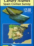 Spain: 25K Canary Islands Civilian Topographic Survey
 Norway: New 50K Topographic Survey Maps
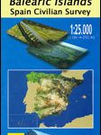 Spain: 25K Balearic Islands Civilian Topographic Survey
 South Africa: 250K Topographic Survey Maps
 Reunion: IGN 25K Topographic Survey Maps
 Spain: CNIG 500K Regional Road Maps
Martinique: IGN 25K Topographic Survey Maps
Soo 25K Lanzarote CNIG Topographic Survey Map No. 1080-III
Eivissa 25K Ibiza CNIG Topographic Survey Map No. 798-IV
Spain: CNIG 500K Regional Road Maps
Martinique: IGN 25K Topographic Survey Maps
Soo 25K Lanzarote CNIG Topographic Survey Map No. 1080-III
Eivissa 25K Ibiza CNIG Topographic Survey Map No. 798-IV
 Germany: Baden-Wรผrttemberg 50K Topographic Survey Leisure Maps
 Mexico: 250K Topographic Survey Maps
Frontera 25K Hierro CNIG Topographic Survey Map No. 1105-IV
Yaiza 25K Lanzarote CNIG Topographic Survey Map No. 1081-IV
Corralejo 25K Fuerteventura CNIG Topographic Survey Map No. 1086-II
La Oliva 25K Fuerteventura CNIG Topographic Survey Map No. 1086-IV
Tindaya 25K Fuerteventura CNIG Topographic Survey Map No. 1090-I
Antigua 25K Fuerteventura CNIG Topographic Survey Map No. 1093-II
Tias 25K Lanzarote CNIG Topographic Survey Map No. 1082-III
Hermigua 25K La Gomera CNIG Topographic Survey Map No. 1095-IV
Mexico: 250K Topographic Survey Maps
Frontera 25K Hierro CNIG Topographic Survey Map No. 1105-IV
Yaiza 25K Lanzarote CNIG Topographic Survey Map No. 1081-IV
Corralejo 25K Fuerteventura CNIG Topographic Survey Map No. 1086-II
La Oliva 25K Fuerteventura CNIG Topographic Survey Map No. 1086-IV
Tindaya 25K Fuerteventura CNIG Topographic Survey Map No. 1090-I
Antigua 25K Fuerteventura CNIG Topographic Survey Map No. 1093-II
Tias 25K Lanzarote CNIG Topographic Survey Map No. 1082-III
Hermigua 25K La Gomera CNIG Topographic Survey Map No. 1095-IV