Disclosure : This site contains affiliate links to products. We may receive a commission for purchases made through these links.
Northern Scotland, Orkney and Shetland Nicolson Road Map 1

Related Products:
 Northern Scotland, Orkney & Shetland OS Road Map 1
 Northern Scotland, Orkney and Shetland Administrative Boundary Wall Map
 CCC Orkney and Shetland Islands: Including North and Northeast Scotland – Edition 2
 The Northern Isles: Orkney and Shetland Sea Kayaking
Southern Scotland & Northumberland Nicolson Road Map 3
The Northern Isles: Orkney and Shetland Sea Kayaking
Southern Scotland & Northumberland Nicolson Road Map 3
 West Scotland & the Western Isles Nicolson Road Map 2
Northern Scotland, Orkney & Shetlands Islands, and the Hebrides c.1900
Admiralty Chart Folio 6 – North and South Coasts of Scotland From Lewis to Firth of Forth incl. Orkney and Shetland Islands
West Scotland & the Western Isles Nicolson Road Map 2
Northern Scotland, Orkney & Shetlands Islands, and the Hebrides c.1900
Admiralty Chart Folio 6 – North and South Coasts of Scotland From Lewis to Firth of Forth incl. Orkney and Shetland Islands
 Orkney Nicolson Tourist Map
 Shetland Nicolson Tourist Map
 Orkney & Shetland: Landscapes in Stone
 Walking on the Orkney and Shetland Isles
 The Viking Isles: Travels in Orkney and Shetland
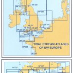 NP209 Tidal Stream Atlas Orkney & Shetland
Scotland Nicolson Tourist Map
NP209 Tidal Stream Atlas Orkney & Shetland
Scotland Nicolson Tourist Map
 Orkney – Shetland Islands Leisure and Tourist Map
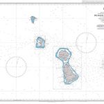
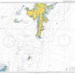
 Admiralty Chart 1239 – Orkney and Shetland Islands
 Admiralty Chart 219 – Western Approaches to the Orkney and Shetland Islands
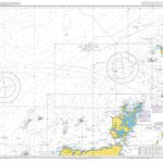
 Admiralty Chart 1119 – Orkney and Shetland Islands Fair Isle Channel
Take the Slow Road: Scotland: Inspirational Journeys Round the Highlands, Lowlands and Islands of Scotland by Camper Van and Motorhome
Admiralty Chart 1119 – Orkney and Shetland Islands Fair Isle Channel
Take the Slow Road: Scotland: Inspirational Journeys Round the Highlands, Lowlands and Islands of Scotland by Camper Van and Motorhome
 Orkney: Northern Isles OS Landranger Map 5 (paper)
 Orkney: Northern Isles OS Landranger Active Map 5 (waterproof)
 North Coast Journey Nicolson Road Map
 Admiralty Chart 2562 – Plans in the Northern Orkney Islands
 Sustrans` Circular Day Rides North: 75 rides in Northern England, Scotland and Northern Ireland
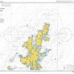 Admiralty Chart 1233 – Northern Approaches to the Shetland Islands
 Backpacker`s Britain Vol 3: Northern Scotland
Northern England and North & Central Scotland c.1900
Backpacker`s Britain Vol 3: Northern Scotland
Northern England and North & Central Scotland c.1900
 Wildlife Awareness Manual: Antarctic Peninsula, South Shetland Islands, South Orkney Islands
 Cycle Touring in Northern Scotland: 528 mile circular route from Inverness
 Orkney Collins Pocket Map – The perfect way to explore Orkney
 Scotland K+F Road Map
 Scotland A-Z Road Atlas
 Southern Scotland & Northumberland OS Road Map 3
 Scotland A-Z Regional Road Atlas
 Scotland Philip`s Navigator Road Atlas
 Northern England OS Road Map 4
Northern England Regional A-Z Road Atlas
Northern England OS Road Map 4
Northern England Regional A-Z Road Atlas
 Northern Italy TCI 400K Road and Tourist Map
 North Coast Journey: The Magic of Scotland`s Northern Highlands