Disclosure : This site contains affiliate links to products. We may receive a commission for purchases made through these links.
Northern England Regional A-Z Road Atlas
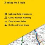
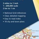
A full colour regional road atlas featuring 52 pages of road mapping that covers an area extending to: Berwick-upon-TweedNewcastle upon TyneMiddlesbroughKingston upon HullGrimsbyBostonNottinghamStoke-on-TrentWrexhamChesterLiverpoolBlackpoolBarrow-in-FurnessDumfries The road mapping is shown at a clear 3.5 miles to 1 inch scale (2.2 km to 1 cm) and includes the following features: Motorways open with full junction detail, motorways under construction and proposed, service areas, primary routes and destinations, A & B roads, selected minor roads, gradients 1:5 and steeper, tolls, mileages, county boundaries, spot heights and hill shadingSelected safety camera locations with their maximum speed limitsSelected fuel stationsNational Park boundariesSelected places of interest, tourist information centres and golf courses Also, within this Northern England Road Atlas are 24 city, town, airport or port plans for: BlackpoolBradfordCarlisleChesterDerbyDumfriesDurhamHarrogateKingston upon HullLeedsLincolnLiverpoolManchesterMiddlesbroughNewcastle upon TyneNottinghamPrestonSheffieldStoke-on-TrentSunderlandYorkManchester AirportKingston upon Hull PortNewcastle upon Tyne Port The index section lists cities, towns, villages, hamlets and locations covered by this atlas.

Related Products:
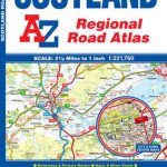 Scotland A-Z Regional Road Atlas
 South East England A-Z Road Atlas
 Britain and Northern Ireland Collins Big Road Atlas 2021 A3 PAPERBACK
 Britain and Northern Ireland Collins Big Road Atlas 2022 A3 PAPERBACK
 Ireland Collins Handy Road Atlas
 Great Britain & Northern Ireland A-Z Road Atlas 2022 A3 PAPERBACK
 Great Britain & Northern Ireland A-Z Road Atlas 2021 A3 PAPERBACK
 Great Britain & Northern Ireland A-Z Road Atlas 2023 A3 PAPERBACK
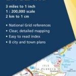
 Southern England A-Z Regional Road Atlas
Britain and Northern Ireland Collins Big Road Atlas 2023 A3 PAPERBACK
Britain and Northern Ireland Collins Big Road Atlas 2023 A3 SPIRAL-BOUND
Southern England A-Z Regional Road Atlas
Britain and Northern Ireland Collins Big Road Atlas 2023 A3 PAPERBACK
Britain and Northern Ireland Collins Big Road Atlas 2023 A3 SPIRAL-BOUND
 Britain and Northern Ireland Collins Big Road Atlas 2022 A3 SPIRAL-BOUND
 Britain and Northern Ireland Collins Essential Road Atlas 2021
 Great Britain & Northern Ireland A-Z Super Scale Road Atlas 2022 A3 SPIRAL-BOUND
Britain and Northern Ireland Collins Essential Road Atlas 2022 A4 SPIRAL-BOUND
Great Britain & Northern Ireland A-Z Super Scale Road Atlas 2022 A3 SPIRAL-BOUND
Britain and Northern Ireland Collins Essential Road Atlas 2022 A4 SPIRAL-BOUND
 Scotland A-Z Road Atlas
Great Britain & Northern Ireland A-Z Super Scale Road Atlas 2023 A3 SPIRAL-BOUND
Scotland A-Z Road Atlas
Great Britain & Northern Ireland A-Z Super Scale Road Atlas 2023 A3 SPIRAL-BOUND
 Northern England AA Road Map 7
 Alps – Northern Italy MairDumont Road Atlas SPIRAL-BOUND
 Europe AA Road Atlas 2020 FLEXI-BOUND
 Great Britain A-Z Road Atlas 2022 A4 SPIRAL-BOUND
 Ireland Collins Road Atlas Touring Edition
 East Anglia A-Z Regional Road Atlas
 Wales A-Z Regional Road Atlas
 Ontario MapArt Back Road Atlas
Poland ExpressMap Road Atlas 2020/2021
Ontario MapArt Back Road Atlas
Poland ExpressMap Road Atlas 2020/2021
 Italy Road Atlas A4 PAPERBACK
Spain Road Atlas 2021 Set (incl. Map and DVD)
Italy Road Atlas A4 PAPERBACK
Spain Road Atlas 2021 Set (incl. Map and DVD)
 Northern England OS Road Map 4
 Slovenia Kartografija Road Atlas
 Kootenay Rockies – Calgary and Northern Montana Back Road Atlas
Ireland Collins Comprehensive Road Atlas
Mexico Road and Tourist Atlas
Kootenay Rockies – Calgary and Northern Montana Back Road Atlas
Ireland Collins Comprehensive Road Atlas
Mexico Road and Tourist Atlas
 Belgium – Netherlands – Luxembourg Marco Polo Road Atlas
 Central Southern England AA Road Map
 South East England AA Road Map
 Europe Collins Handy Road Atlas
 British Columbia MapArt Road Atlas
 Scotland Philip`s Navigator Road Atlas
Great Britain A-Z Road Atlas 2023 A4 SPIRAL-BOUND
Scotland Philip`s Navigator Road Atlas
Great Britain A-Z Road Atlas 2023 A4 SPIRAL-BOUND