Disclosure : This site contains affiliate links to products. We may receive a commission for purchases made through these links.
Northeastern USA – Eastern Canada Michelin Regional 583
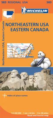
North-eastern USA and Eastern Canada at 1:2,400,000 (1″ to 38 miles) on an indexed road map from Michelin with coverage extending westwards to the western borders of the Dakotas and Nebraska, and south beyond Washington DC to Norfolk in Virginia and, in the west, to St. Louis and Kansas City.The map is part of Michelin’s series covering USA on three maps at this scale. Road network indicates toll roads and clearly shows road numbers of interstate and state highways plus on selected local roads. Driving distances are marked on main routes in both miles and kilometres, and on selected state roads in kilometres only. State borders are clearly marked and the maps also show time zone boundaries. Topography is indicated by relief shading, with colouring for national/state parks and forests, Indian lands and restricted entry military zones. The maps have no geographical coordinates; each title is indexed.To see all the titles in this series, including more detailed coverage of New England and the Mid-Atlantic States, please click on the series link.

Related Products:
 Western USA – South Western Canada Michelin Regional 585
 Southeastern USA Michelin Regional 584
 USA: Michelin Regional Road Maps
 New England – Hudson Valley Michelin Regional 581
 Midatlantic – Allegheny Highlands Michelin Regional 582
 Northern England – Midlands Michelin Regional 502
 Wales – South West England – Midlands Michelin Regional 503
 Scotland Michelin Regional 501 WATERPROOF
 Scotland Michelin Regional 501
 Germany Southeast – Bavaria Michelin Regional 546
 South East England – Midlands – East Anglia Michelin Regional 504
 Brittany Michelin Regional 512
 USA Michelin
 Belgium North & Centre Michelin Regional 533
 Italy South Michelin Regional 564
 Germany Southwest Michelin Regional 545
 Champagne-Ardenne Michelin Regional 515
 Germany Mideast Michelin Regional 544
 Auvergne – Limousin Michelin Regional 522
 Loire Valley Michelin Regional 517
 Italy North East Michelin Regional 562
 Burgundy Michelin Regional 519
 Franche-Comte Michelin Regional 520
 Alsace – Lorraine Michelin Regional 516
 Languedoc-Roussillon Michelin Regional 526
 Poitou-Charentes Michelin Regional 521
 Aquitaine Michelin Regional 524
 Central France Michelin Regional 518
 Nord-Pas-de-Calais – Picardy Michelin Regional 511
 Midi-Pyrรฉnรฉes Michelin Regional 525
 Paris & Surrounding Areas Michelin Regional 514
 Belgium South Michelin Regional 534
 Germany Northeast Michelin Regional 542
 Normandy Michelin Regional 513
 Texas – Oklahoma Michelin Zoom 176
 Netherlands North Michelin Regional 531
 Southern Rockies – Arizona – Colorado – New Mexico – Utah Michelin Zoom 175
 Provence-Alps – French Riviera Michelin Regional 527
 Rhรดne-Alpes Michelin Regional 523
 Netherlands South Michelin Regional 532