Disclosure : This site contains affiliate links to products. We may receive a commission for purchases made through these links.
North West Surrey 1888
North West Surrey in 1888 in a series of reproductions of Ordnance Survey’s famous “Inch to the Mile” maps published in the Alan Godfrey Editions to provide a historical record of England and Wales in the second half of 19th and early 20th century.Coverage stretches from Farnham and Aldershot Common eastward to East Horsley and Hackhurst Downs, and from Camberley southward to Godalming. Features include North Camp and South Camp near Aldershot, Chobham Ridge, the Basingstoke Canal, Woking Convict Prison, Brookwood Lunatic Asylum, Albury Park and much more. Other locations covered include Ash, Bisley, Bramley, Byfleet, Compton, East Clandon, Elstead, Farnham, Frimley, Guildford, Horsell, Merrow, Normandy, Ockham, Pepeharow, Pirbright, Puttenham, Pyrford, Ripley, Seale, Send, Shalford, Shere, St Martha, Wanborough, West Clandon, West Horsley, Wonersh and Worplesdon. On the reverse is amore detailed map showing part of Worplesdon, plus a directory for that village. About the Alan Godfrey Editions of the OS Inch to the Mile Maps: the maps provide an invaluable overview of a wider area, typically 18 x 12 miles (29 x 19 kms approx.), and offer historical mapping for small towns and villages not covered by the more detailed series for which the Godfrey Editions are better known. On the reverse all the maps have historical notes and most titles also include a more detailed, large scale map of a small town or a village in the area.To see other titles in this series please click on the series link.

Related Products:
 North Chilterns 1888
North West Gloucestershire 1896
The Solent 1888
Penzance and St Ives Bay 1888
East Surrey and Mole Valley 1885
North Chilterns 1888
North West Gloucestershire 1896
The Solent 1888
Penzance and St Ives Bay 1888
East Surrey and Mole Valley 1885
 Hanworth and North West Hampton 1934
South West Berkshire 1889
North London 1902-13 – 256
North Tynedale 1902 – 13
North Kent Coast 1878
Worcester North-West 1902
Exeter and the Lower Exe Valley 1888
North Dartmoor and Mid-Devon 1887
North East Essex and Dedham Vale 1904
Hanworth and North West Hampton 1934
South West Berkshire 1889
North London 1902-13 – 256
North Tynedale 1902 – 13
North Kent Coast 1878
Worcester North-West 1902
Exeter and the Lower Exe Valley 1888
North Dartmoor and Mid-Devon 1887
North East Essex and Dedham Vale 1904
 Sedgley South-East with Swan Village and West Coseley 1901
 West Drayton South 1935
 No Place, Beamish and West Pelton 1895
Devon North: Taw and Torridge Valleys 1907
Wolverhampton North West 1901
Aldershot 1909
Leicester North West 1902
Flodden Field & North Cheviots 1901 – 3
No Place, Beamish and West Pelton 1895
Devon North: Taw and Torridge Valleys 1907
Wolverhampton North West 1901
Aldershot 1909
Leicester North West 1902
Flodden Field & North Cheviots 1901 – 3
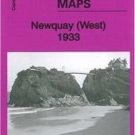 Newquay West 1933
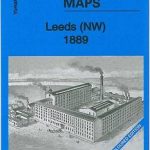 Leeds North West 1889 (Colour Edition)
Manchester North West and Central Salford 1915
Leeds North West 1889 (Colour Edition)
Manchester North West and Central Salford 1915
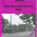 West Bromwich (North) 1885 – 68.06a Coloured Edition
Sevenoaks and Tonbridge 1893
Fareham, Hambledon and Havant 1894
Beachy Head, Newhaven and Eastbourne 1880 – 1903
West Bromwich (North) 1885 – 68.06a Coloured Edition
Sevenoaks and Tonbridge 1893
Fareham, Hambledon and Havant 1894
Beachy Head, Newhaven and Eastbourne 1880 – 1903
 Shrewsbury West 1900
South West Suffolk 1893
Maldon West 1920 – 55.16
Tannochside & North Uddingston 1935 – 11.03
Isle of Thanet 1893 – 274
Glasgow North East 1893
Carlisle North-East 1924
Shrewsbury West 1900
South West Suffolk 1893
Maldon West 1920 – 55.16
Tannochside & North Uddingston 1935 – 11.03
Isle of Thanet 1893 – 274
Glasgow North East 1893
Carlisle North-East 1924
 Bromley Common and North-East Hayes 1895
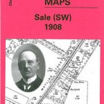 Sale South-West 1908
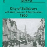 City of Salisbury with West Harnham & East Harnham 1900 – 66.15
Redesdale 1866
City of Salisbury with West Harnham & East Harnham 1900 – 66.15
Redesdale 1866