Disclosure : This site contains affiliate links to products. We may receive a commission for purchases made through these links.
North East New South Wales Hema
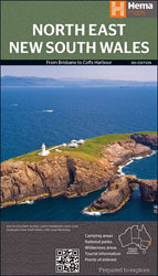
Hemaโ€s regional road map of North East New South Wales covering at 1:375,000 the coastal region from south of Coffs Harbour northwards across the state border to Brisbane, and extending inland across the Great Dividing Range to beyond the New England Highway; the reverse side has extensive tourist information.Topography is shown by relief shading with names of mountain ranges and selected peaks. Numerous national or state parks, reserves and forests are prominently highlighted. Symbols indicate campsites and caravan parks, rest areas with overnight accommodation, 24hour fuel supplies, information centres, places of interest, etc. Numerous wineries are highlighted, particularly around Stanthorpe – the Granite Belt of Queensland – which is also presented in greater detail on a separate panel. Latitude and longitude lines are drawn at 10` intervals.The reverse side is filled with descriptions of the regionโ€s best sights and includes a table of facilities in local national parks both in New South Wales and in Queensland. Also provided are contact addresses for tourist information offices and a distance table.To see the list of titles in Hemaโ€s series of regional maps of Australia please click on the series link.


