Disclosure : This site contains affiliate links to products. We may receive a commission for purchases made through these links.
North Downs Way Harvey National Trail XT40
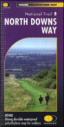
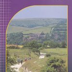
The whole of the North Downs Way, a 246km / 153 miles National Trail between Dover and Farnham, on a light, waterproof and tear-resistant map at 1:40,000 from Harvey Map Services presenting the route accompanied by extensive additional tourist information. This new edition published in autumn 2013 replaces the publishers’ previous coverage of the North Downs Way on two separate maps.Divided into 11 panels, the route is shown on mapping with contours at 10m intervals. Colouring indicates land cover: pastures, orchards, woodlands, etc. The overprint highlighting the route shows whether it is on track, path, not visible path or road, with possible danger points clearly marked. The mapping also highlights other local right of way paths. A wide range of symbols shows various facilities and tourist attractions, including campsites, youth hostels and other accommodation options, food shops and pubs, banks, etc. Each panel has the lines of the British National Grid. Accompanying text provides contact details for tourist information, accommodation bookings, public transport services, etc. Map legend and general notes are also in French and German.To see the full list of Harvey’s maps of long-distance trails please click on the series link.

Related Products:
 Pennine Way South Harvey XT40 National Trail Map
 St Oswald`s Way Harvey National Trail XT40
 South Downs Way Harvey National Trail XT40
 East Highland Way Harvey National Trail XT40
 Settle to Carlisle Way Harvey National Trail XT40
 Pembrokeshire Coast Path Harvey National Trail XT40
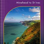 South West Coast Path 1 – Minehead to St Ives Harvey National Trail XT40
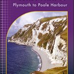 South West Coast Path 3 – Plymouth to Poole Harbour Harvey National Trail XT40
 Pennine Way North Harvey XT40 National Trail Map
 South West Coast Path 2 – St Ives to Plymouth Harvey National Trail XT40
 Hadrian`s Wall Path Harvey National Trail XT40
 Northumberland Coast Path & Berwickshire Coastal Path Harvey National Trail XT40
 Two Moors Way Harvey National Trail XT40
 Cleveland Way Harvey National Trail XT40
 Cape Wrath Trail North – Strathcarron to Cape Wrath Harvey National Trail XT40
 Rob Roy Way Harvey National Trail XT40
Cotswold Way Harvey National Trail XT40
Rob Roy Way Harvey National Trail XT40
Cotswold Way Harvey National Trail XT40
 Cumbria Way Harvey National Trail XT40
 The Great Trossachs Path Harvey National Trail XT40
 St Cuthbert`s Way Harvey National Trail XT40
Ridgeway Harvey National Trail XT40
St Cuthbert`s Way Harvey National Trail XT40
Ridgeway Harvey National Trail XT40
 Dales Way Harvey National Trail XT40
 Glyndwr`s Way Harvey National Trail XT40
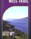 South Loch Ness Trail Harvey National Trail XT40
 Peddars Way & Norfolk Coast Path Harvey National Trail XT40
 Affric Kintail Way Harvey National Trail XT40
Speyside Way Harvey National Trail XT40
West Highland Way Harvey National Trail XT40
Affric Kintail Way Harvey National Trail XT40
Speyside Way Harvey National Trail XT40
West Highland Way Harvey National Trail XT40
 Shropshire Way Harvey National Trail XT40
 Cape Wrath Trail South – Fort William to Strathcarron Harvey National Trail XT40
 Great Glen Way Harvey National Trail XT40
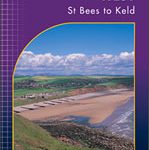 Coast to Coast West – St Bees to Keld Harvey National Trail XT40
 North Downs Way: National Trail Guide
 Offa`s Dyke Path Harvey National Trail XT40
 John O`Groats Trail Harvey National Trail XT40
 North Downs Way A-Z National Trail Road Map
 Anglesey Coastal Path Harvey National Trail XT40
 Skye Trail Harvey National Trail XT40
 Pennine Bridleway Harvey XT40 National Trail Map