Disclosure : This site contains affiliate links to products. We may receive a commission for purchases made through these links.
North Devon Cycling Map 82

The northern half of Devon at 1:100,000 on a handy size, 50x35cm, double-sided contoured map from Croydecycle, printed on waterproof and tear-resistant synthetic paper and showing National Cycle routes and numerous local facilities, including campsites, pubs, etc. Coverage extends along the northern coast from the Somerset border to Clovelly, with the Harland area to the Cornish border shown as an inset; on the reverse the map extends southwards to Exeter and Okehampton. Contours are at 30m intervals, with colouring for woodlands (indicating those with public access), sandy or pebble beaches, plus moors and common or other access land. Interesting landscape features are highlighted with grading. Road network indicates A and B road numbers and has gradient markings. On roads which are part of the National Cycle Network route numbers are marked. Symbols indicate numerous facilities: campsites and caravan sites, pubs and cafes, car parks and picnic sites, local shops, cycle hire, tourist information, etc. National Grid coordinates are marked in the margins. Small panels provide street plans of Ilfracombe, Barnstaple, Bideford and Torrington.To see other titles in this series please click on the series link.

Related Products:
 South Devon Cycling Map 83
 East Devon – Exeter Cycling Map 85
 Cornwall East – Bodmin/St Austell to West Devon Cycling Map 81
 Exmoor & Taunton Cycling Map 84
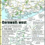 Cornwall West – Lands End to Bodmin/St Austell Cycling Map 80
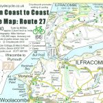 Devon Coast to Coast – Route 27 Cycle Map 66
 Totnes & Dartmouth Cycle Map 62
 Totnes Walking Map 28
 Budleigh Salterton & Otterton Walking Map 40
 Braunton & Ilfracombe Cycle Map 60 – with Tarka Trail & Barnstaple
 Dartmouth – Dittisham & Coast to Brixham Walking Map 26
 Exmouth & Sidmouth Cycle Map 61
 North Friesland – Schleswig Cycling Map 1
 The North West Trail Cycle Route
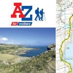
 South West Coast Path 1 – North Devon & Somerset A-Z Adventure Atlas
 Coast & Castles Cycle Route North: Edinburgh – Aberdeen
 Lรดn Las Cymru Cycle Route North: Holyhead – Llanidloes
 Netherlands North Cycling Map NL1
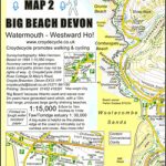 South West Coast Path Map 2 – Big Beach Devon – Watermouth – Westward Ho! Map 58
 Netherlands North Super-Durable Cycling Map 1
 Niederrhein North Cycling Map
 Albania North
Rhine-Main – North Hesse Cycling Map 16
Kassel – North Hesse Cycling Map
Albania North
Rhine-Main – North Hesse Cycling Map 16
Kassel – North Hesse Cycling Map
 Exmoor – North Devon Cycling Country Lanes & Traffic-Free Family Routes
Heilbronner Land – Stuttgart North Cycling Map
Schleswig-Holstein North Sea Coast with Islands Cycling Map
Exmoor – North Devon Cycling Country Lanes & Traffic-Free Family Routes
Heilbronner Land – Stuttgart North Cycling Map
Schleswig-Holstein North Sea Coast with Islands Cycling Map
 Devon North Sustrans Cycle Map 3 – Including the Tarka Trail
 Hanoi – Vietnam North ITMB
 Benelux – North France Michelin Road Atlas SPIRAL-BOUND
 The Salmon Run – Dundee to Pitlochry Cycle Route
 Strangford Lough Cycle Trail
 North Sea Coast Cycle Route 3 – Hamburg to Danish Border
 Northern Zealand Cycling Map & Cycle Guide
 North Limburg – De Pell and De Maasduinen Falkplan Cycling Map 19
 South West Coast Path 4 – South Devon Adventure Atlas
 Sea to Sea Cycle Route: Whitehaven/Workington – Newcastle/Sunderland
 Devon – Cornwall – West Somerset A-Z Visitors` Atlas & Guide
 South Devon – Brixham to Newton Ferrers OS Explorer Map OL20 (paper)