Disclosure : This site contains affiliate links to products. We may receive a commission for purchases made through these links.
North Argentina de Dios Regional Map

North-western Argentina on a handy size, waterproof and tear-resistant concertina map from the Buenos Aires-based De Dios providing an overview road map of the region, five additional more detailed panels showing recommendations for sightseeing circuits, plus four street plans. This 2007 version of this title includes:- An overview map at 1:4,500,000 of the whole region, with towns, main roads and numerous places of interest.- Five sightseeing circuits on panels at scales between 1:1,000,000 and 1:1,600,000 showing the road network in more detail with locations of petrol stations and campsites: 1- Circuito Puna in the northernmost corner of the region at 1:1,600,000; 2 – Circuito Quebrada de Humahuaca north of San Salvador de Jujuy at 1:1,400,000; 3 – Circuito Valles Calchaquies south-west of Salta at 1:1,100,000; 4 – Circuito Tren de las Nubes west of Salta at 1:1,200,000; 5 – Circuito Atacama in Chile between San Pedro de Atacama and Antofagasta at 1:1,500,000- Four street plans of the centres of Salta, San Salvador de Jujuy, Tucuman and Catamarca, annotated with various facilities and places of interest.Road maps in the De Dios series do not aim to provide a detailed picture of the region’s road network, but are designed to highlight interesting routes or main tourist attractions. Similarly, the more detailed maps of hiking areas provide just the basic indication of the topography, with very general altitude colouring, spot heights for main peaks, plus rivers and lakes, and show access roads, refuges, campsites and other accommodation facilities, viewpoints, and recommended hiking routes. The street plans show town centres with main hotels, places of interest, bus terminals, petrol stations, etc. The maps have no geographical coordinates. Map legends are in Spanish. To see the other titles in this series please click on the series link.

Related Products:
 Argentina ACA Regional Zone 1 – North
 El Chaten – El Calafate de Dios Regional Map
Argentina: de Dios Tourist Maps of Popular Regions
El Chaten – El Calafate de Dios Regional Map
Argentina: de Dios Tourist Maps of Popular Regions
 Peninsula Valdes de Dios Regional Map
Bariloche – Siete Lagos de Dios Regional Map
Peninsula Valdes de Dios Regional Map
Bariloche – Siete Lagos de Dios Regional Map
 Iguazu Falls de Dios Regional Map
 Jujuy and Salta Provinces
 Argentina North & Uruguay ITMB
 Argentina ACA Regional Zone 3 – Region Litoral
 Argentina ACA Regional Zone 7 – Patagonia North
 Argentina ACA Regional Zone 5 – Region Cuyo (incl. Aconcagua – Mendoza – San Luรญs)
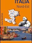 Italy North East Michelin Regional 562
 Argentina: Firestone Regional Road Maps
 Italy North West Michelin Regional 561
 Argentina ACA Regional Zone 6 – Region Buenos Aires
 Argentina ACA Regional Zone 4 – Region Centro
 Argentina Borch
 Germany North West Michelin Regional 541
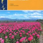
 Portugal North Michelin Regional 591
 Australia: UBD Gregory`s Regional Road Maps
 Argentina ACA Regional Zone 2 – Region Cuyo y Norte
 Bahia de Dios Map-Guide
 Netherlands North Michelin Regional 531
 Italy Central Michelin Regional 563
 Palmerston North Pathfinder
 Argentina ACA Regional Zone 9 – Patagonia South
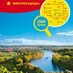 Bavaria North Marco Polo Regional Map 12
 Argentina ACA Regional Zone 8 – Patagonia Central
 Argentina North – Uruguay Nelles
 Andalucia Michelin Regional 578
 Argentina de Dios Map-Guide
 Comunidad Valenciana – Murcia Michelin Regional 577
 North Rhine-Westphalia Marco Polo Regional Map 5
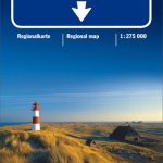 North Sea Coast – Bremen – Hamburg K+F Regional Road Map
 Belgium North & Centre Michelin Regional 533
 Italy South Michelin Regional 564
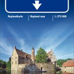 North Rhine-Westphalia – Cologne – Ruhr Area K+F Regional Road Map
 Indonesia: Periplus Regional Maps
 Aragon – Catalonia Michelin Regional 574
 Galicia Michelin Regional 571