Disclosure : This site contains affiliate links to products. We may receive a commission for purchases made through these links.
North Annapurna Base Camp

Trekking route s to the North Annapurna Base Camp in the Nepa Maps series which provides extensive coverage of trekking areas of Nepal on detailed contoured maps with trekking routes and hiking trails, huts and camp sites, local places of interest and other tourist information.Cartography is based on the country’s topographic survey, with contours usually at 40m or 50m intervals, enhanced by relief shading, colouring and graphics to show various features of the terrain, including glaciers, forested or cultivated areas, etc. Numerous peaks, with additional spot heights, plus names of glaciers and mountain ranges are prominently shown. The network of rivers, streams and lakes is shown in great detail, with many smaller rivers and lakes named. Overprint highlights main trekking routes and numerous local trails, with symbols indicating various places of interest and tourist facilities. Most maps are indexed and include additional information such as route profiles, glossaries, etc. All the information is in English and heights are given in metres.*In this title:* trekking route along the Kali Gandaki from Beni to Jomoson with a spur across the Thulobugin Pass (Pass April 27) to the North Annapurna Base Camp. Also included are routes to the river from Ghandruk and Ghorepani, plus the trail from Ghandruk to the Machhapuchhre Base Camp and the camps on the south side of Annapurna I. Contours are at 40m intervals, with bold relief shading and vegetation colouring. Index lists settlements, peaks and passes. Margin ticks give latitude and longitude at 5’ intervals. Also included is a profile of the main route and a table showing the route in stages with altitudes in metres and feet, plus trekking times.

Related Products:
 Annapurna Base Camp
 Makalu Base Camp
 Everest Base Camp & Gokyo – Three Passes 50K
 Everest: Jiri to Everest Base Camp
 Mustang to Annapurna
 Tenzing-Hillary Trek – Jiri to Everest Base Camp
 Ganesh Himal – Paldor Base Camp
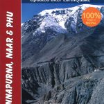 Annapurna, Naar & Phu Great Himalaya Trail Map
 Around Annapurna (125K)
 Around Annapurna (100K)
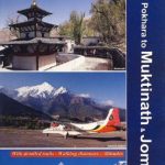 Pokhara to Muktinath and Jomosom
 Annapurna Trekking Atlas
 Annapurna Trekking Guide
 Everest Base Camp NGS Adventure Map 3001
 Lukla to Gokyo – Cho-La – Renjo-La – Nagpa-La
 Kanchenjunga
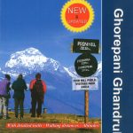 Ghorepani – Ghandruk
 Tilicho Hidden Lake
 Cho Oyu
 Everest: A Trekker`s Guide: Base Camp, Kala Patthar and other trekking routes in Nepal and Tibet
 Annapurna Himal
 Mera Peak
 Annapurna
 Upper Mustang
 Upper & Lower Mustang
 Damodar Himal
 Mustang Upper and Lower
 Naar – Phu
 Dhaulagiri Circuit
 Pisang Peak
 Annapurna: 14 Classic Treks Including Annapurna Circuit
 Annapurna NGS Adventure Map 3003
 Numbur Cheese Circuit
 Annapurna, Machhapuchhare, Marsyangdi & Muktinath Area
 Tumlingtar to Lukla
 Tatopani Trek
 Bhairab Kund
 Lukla to Tengboche
 Gosainkunda – Trek to Shiva`s Sacred Lake
 Naya Kanga