Disclosure : This site contains affiliate links to products. We may receive a commission for purchases made through these links.
Normandy D-Day – 6 June 1944 IGN Map
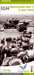
Commemorative map from the IGN for the 70th anniversary of the D-Day landings in Normandy on 6th June 1944, presenting in three large panels various grouping of the Allied Armies and the defending German forces, the changes in the front lines between 6th June and 18th August, and present day commemorative sites and monuments, plus additional bilingual notes. The main panel at 1:100,000 shows the five beaches: Utah, Omaha, Gold, Juno and Sword together with the command structure and the disposition of the Allied Forces, from General Eisenhower to individual units including the supporting airborne divisions, and the defending German forces, plus indicates beach heads and the front line 24 hours later.A smaller panel at 1:500,000 shows the whole of the Cotintin Peninsula indicating changes in the front line between D-Day and 18th August 1944. Another large panel at 1:250,000 shows north-western Normandy, including Caen and Bayeux, indicating museums, war memorials, military cemeteries and other WWII related information including a suggested tour of the five beaches. Also provided is a map showing the disposition of the armies on both sides of the Channel prior to D-Day, General Eisenhower’s proclamation to the Allied Expeditionary Force, and notes on the Operation Overlord. Map legend and additional text include English.PLEASE NOTE: this title is also available as a wall map with the map legend which includes English but with the additional text, apart from General Eisenhower’s proclamation, in French only.

Related Products:
 D-Day: The Battle of Normandy, 6th June 1944 Orep Editions Historical Map
 Six Armies in Normandy: From D-Day to the Liberation of Paris June 6th-August 25th,1944
 6th Airborne: Normandy 1944
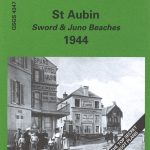 St Aubin – Sword & Juno Beaches 1944 – 40/18 SW
 Omaha Beach: Normandy 1944
 The Normandy Battlefields: Bocage and Breakout: from the Beaches to the Falaise Gap
 St Pierre du Mont (Omaha Beach) 1944
 Ouistreham (Pegasus Bridge) 1944
 Italy World War II 1940-1945 Edizioni Multigraphic Map
 Battle of Normandy Michelin Map
 The Definitive Battlefield Guide to the D-Day Normandy Landing Beaches
 Road to Liberty 1944/1945 Michelin Map
 Normandy 1944 – The Atlantic Wall
 The Cruel Victory: The French Resistance and the Battle for the Vercors 1944
 Forgotten Voices of D-Day: A Powerful New History of the Normandy Landings in the Words of Those Who Were There
 The Gothic Line 1944 – 1945: Western Section Ed. Multigrapic Map
 D-Day and Normandy: A Visual History
 Major & Mrs Holt`s Definitive Battlefield Guide to the D-Day Normandy Landing Beaches: 75th Anniversary Edition with GPS References
 Battle of the Somme 1916 IGN Map
 101st Airborne: Market Garden 1944
 The Western Front
 Battle of Verdun 1916 IGN Map
 Hohensyburg and Westhofen 1944 British War Office Survey Map
 Dortmund North 1944 British War Office Survey Map
 Duisburg North: Hamborn and Bruckhausen 1944 British War Office Survey Map
 Hagen 1944 British War Office Survey Map
 Snow and Steel: Battle of the Bulge 1944-45
 War in Val d`Orcia: An Italian War Diary 1943-1944
 The Normandy D-Day Landing Beaches Major & Mrs Holt`s Battle Map
 D-Day: The Battle for Normandy
 World War II – Invasion to Liberation
 The Somme Fir Tree Aerial Map
 Gallipoli Campaign Map and Guide
 Koln (S) 1944: Cologne Sheet 2
 Koln (N) 1944: Cologne Sheet 1
 France: Alan Godfrey Reproductions of the GSGS Bigot Plans for the D-Day Landings
 The Normandy Battlefields: D-Day and the Bridgehead
 Normandy: Guide to the Beaches and Battlefields
 The Great War 1914 – 1918 IGN Map
 The D-Day Atlas: Anatomy of the Normandy Campaign