Disclosure : This site contains affiliate links to products. We may receive a commission for purchases made through these links.
NOAA Charts for Cape Hatteras to Delaware River

Related Products:
 NOAA Charts for Jacksonville, Florida to Cape Hatteras
 Admiralty Chart 2861 – Delaware Bay to Cape Hatteras
 NOAA Chart 13003 – Cape Sable to Cape Hatteras
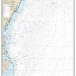 NOAA Chart 12200 – Cape May to Cape Hatteras
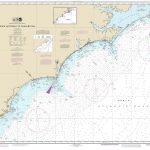 NOAA Chart 11520 – Cape Hatteras to Charleston
 NOAA Chart 12311 – Delaware River’”Smyrna River to Wilmington
 NOAA Chart 11009 – Cape Hatteras to Straits of Florida
 NOAA Chart 11555 – Cape Hatteras’”Wimble Shoals to Ocracoke Inlet
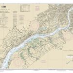 NOAA Chart 12312 – Delaware River’”Wilmington to Philadelphia
 NOAA Chart 12314 – Delaware River’”Philadelphia to Trenton
 NOAA Charts for Long Island Sound to Cape Cod Canal
 NOAA Chart 12313 – Delaware River’”Philadelphia and Camden Waterfronts
 NOAA Charts for San Francisco Bay and Sacramento River
 NOAA Charts for New York Harbor and Hudson River
 NOAA Charts for Texas from Rio Grande to Sabine River
 Admiralty Chart 2603 – Delaware River – Delaware Point to Little Tinicum Island
 Admiralty Chart 2864 – Cape Hatteras to Cape Romain
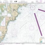 NOAA Chart 13286 – Cape Elizabeth to Portsmouth – Cape Porpoise Harbor – Wells Harbor – Kennebunk River – Perkins Cove
 NOAA Chart 11537 – Cape Fear River’”Cape Fear to Wilmington
 NOAA Chart 11543 – Cape Lookout to New River
 NOAA Chart 11536 – Approaches to Cape Fear River
 NOAA Chart 11539 – New River Inlet to Cape Fear
 NOAA Chart 14853 – SMALL-CRAFT BOOK CHART – Detroit River, Lake St. Clair and St. Clair River (book of 47 charts)
 NOAA Charts for Alaska Coast (Planning Charts)
 NOAA Chart 12216 – Cape Henlopen to Indian River Inlet – Breakwater Harbor
 NOAA Chart 11534 – Intracoastal Waterway’”Myrtle Grove Sound and Cape Fear River to Casino Creek
 NOAA Chart 14916 – SMALL-CRAFT BOOK CHART – Lake Winnebago and Lower Fox River (book of 34 charts)
 Instructional Chart 5135 – Cape Breton to Delaware Bay
 Admiralty Chart 2670 – Cape Breton to Delaware Bay
 Admiralty Chart 2563 – Approaches to Delaware River
 NOAA Chart 16662 – Cook Inlet’”Kalgin Island to North Foreland – Drift River – Kasilof River to Kenai River – Nikiski
 Admiralty Chart 2604 – Delaware River – Philadelphia and Camden
 Admiralty Chart 2605 – Delaware River – Philadelphia to Trenton
 NOAA Chart 12304 – Delaware Bay
 NOAA Chart 12277 – Chesapeake and Delaware Canal
 Quebec, St Lawrence River and Anticosti Island Charts
 NOAA Chart 16122 – Cape Dyer to Cape Lisburne
 NOAA Chart 16518 – Cape Kovrizhka to Cape Cheerful
 NOAA Chart 16598 – Cape Ikolik to Cape Kuliuk
 NOAA Chart 16608 – Cape Douglas to Cape Nukshak


