Disclosure : This site contains affiliate links to products. We may receive a commission for purchases made through these links.
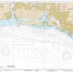
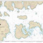
NOAA Chart 17423 – Harbors in South Alaska

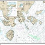
NOAA Chart 17423 – Harbor Charts’”Clarence Strait and Behm Canal – Union Bay’”Cleveland Peninsula – Naha Bay’”Revillagigedo Island – Tolstoi and Thorne Bays’”Prince of Wales lsland – Dewey Anchorage’”Etolin Island – Ratz Harbor’”Prince of Wales IslandNOAA maintains the nautical charts and publications for U.S. coasts and the Great Lakes. Over a thousand charts cover 95,000 miles of shoreline and 3.4 million square nautical miles of waters.Printed on demand using the most up to date NOAA data and latest Notice to Mariners (NTMs) applied at time of print. Meets United States Coast Guard carriage requirements.Printed in house at Stanfords.

Related Products:
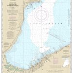
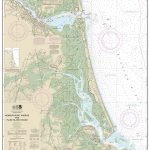
 NOAA Chart 19353 – Harbors of Moloka`i – Kamalo Harbor – Kaunakakai Harbor – Kolo Harbor – Lono Harbor – Puko`o Harbor
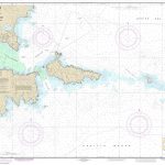
 NOAA Chart 17433 – Prince of Wales Island’”Kendrick Bay to Shipwreck Point
 NOAA Chart 17381 – Red Bay’”Prince of Wales Island
 NOAA Chart 13275 – Salem and Lynn Harbors – Manchester Harbor
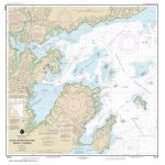
 NOAA Chart 17435 – Harbors in Clarence Strait – Tamgas Harbor – Port Chester – Metlakatla Harbor
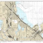 NOAA Chart 14929 – Calumet and Indiana Harbors
 NOAA Chart 13253 – Harbors of Plymouth, Kingston and Duxbury – Green Harbor
 NOAA Chart 16549 – Alaska Peninsula’”Cold Bay and Approaches – King Cove Harbor
 NOAA Chart 16005 – Cape Prince of Wales to Point Barrow
 NOAA Chart 18428 – Oak and Crescent Harbors
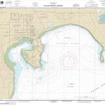
 NOAA Chart 16595 – Kodiak and St. Paul Harbors – Kodiak Harbor
 NOAA Chart 13269 – Cohasset and Scituate Harbors
 NOAA Chart 14917 – Menominee and Marinette Harbors
 NOAA Chart 14974 – Ashland and Washburn Harbors
 NOAA Chart 13276 – Salem, Marblehead and Beverly Harbors
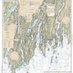
 NOAA Chart 13307 – Camden, Rockport and Rockland Harbors
 NOAA Chart 18751 – Los Angeles and Long Beach Harbors
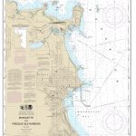 NOAA Chart 14970 – Marquette and Presque Isle Harbors
 NOAA Chart 16011 – Alaska Peninsula and Aleutian Islands to Seguam Pass
 NOAA Chart 13282 – Newburyport Harbor and Plum Island Sound
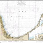
 NOAA Chart 14906 – South Haven to Stony Lake – South Haven – Saugatuck Harbor – Port Sheldon
 NOAA Chart 12362 – Port Jefferson and Mount Sinai Harbors
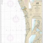
 NOAA Chart 14905 – Waukegan to South Haven – Michigan City – Burns International Harbor – New Buffalo
 NOAA Chart 11324 – Galveston Bay Entrance, Galveston and Texas City Harbors
 NOAA Chart 19366 – Pearl Harbor’”South Coast of O`ahu
 NOAA Chart 16436 – Shemya Island – Alcan Harbor – Skoot Cove
 NOAA Chart 19329 – Mahukona Harbor and Approaches’”Island of Hawai`i
 NOAA Chart 17365 – Woewodski and Eliza Harbors – Fanshaw Bay and Cleveland Passage
 NOAA Chart 19367 – Island of O`ahu’”Honolulu Harbor
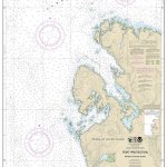 NOAA Chart 17378 – Port Protection’”Prince of Wales Island
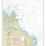
 NOAA Chart 17426 – Kasaan Bay’”Prince of Wales Island – Clark Bay – Hollis Anchorage (eastern part) – Lyman Anchorage
 NOAA Chart 19369 – South Coast of O`ahu’”Approaches to Pearl Harbor
 NOAA Chart 16515 – Unalaska Island’”Chernofski Harbor to Skan Bay
 NOAA Chart 13293 – Damariscotta, Sheepscot and Kennebec Rivers – South Bristol Harbor – Christmas Cove
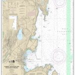
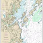 NOAA Chart 13292 – Portland Harbor and Vicinity
 NOAA Chart 11441 – Key West Harbor and Approaches
 NOAA Chart 13232 – New Bedford Harbor and Approaches
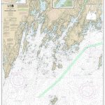 NOAA Chart 13301 – Muscongus Bay – New Harbor – Thomaston
 NOAA Chart 13321 – Southwest Harbor and Approaches
 NOAA Chart 16442 – Kiska Harbor and Approaches