Disclosure : This site contains affiliate links to products. We may receive a commission for purchases made through these links.
NOAA Chart 17330 – West Coast of Baranof Island’”Cape Ommaney to Byron Bay
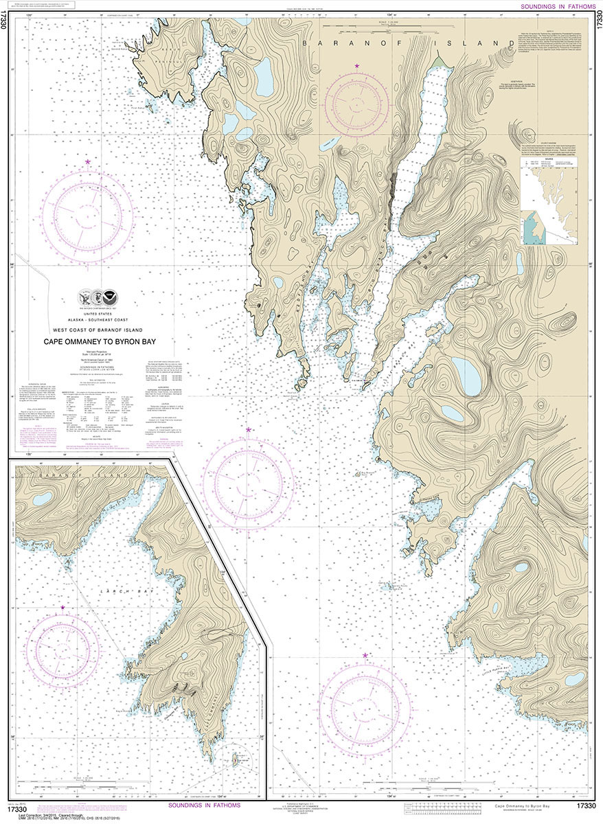
NOAA maintains the nautical charts and publications for U.S. coasts and the Great Lakes. Over a thousand charts cover 95,000 miles of shoreline and 3.4 million square nautical miles of waters.Printed on demand using the most up to date NOAA data and latest Notice to Mariners (NTMs) applied at time of print. Meets United States Coast Guard carriage requirements.Printed in house at Stanfords.
Related Products:
 NOAA Chart 17322 – West Coast of Chichagof Island’”Khaz Bay – Elbow Passage
 NOAA Chart 12214 – Cape May to Fenwick Island
 NOAA Chart 19442 – Lisianski and Laysan Islands – West Coast of Laysan Island
 NOAA Chart 13229 – South Coast of Cape Cod and Buzzards Bay
 NOAA Chart 25671 – West Coast of Puerto Rico
 NOAA Chart 11460 – Cape Canaveral to Key West
 NOAA Chart 13288 – Monhegan Island to Cape Elizabeth
 NOAA Chart 17328 – Baranof lsland’”Snipe Bay to Crawfish Inlet
 NOAA Chart 16518 – Cape Kovrizhka to Cape Cheerful
 NOAA Chart 11006 – Gulf Coast’”Key West to the Mississippi River
 NOAA Chart 17325 – South and West Coasts of Kruzof Island
 NOAA Chart 19327 – West Coast of Hawai’i’”Cook Point to Upolu Point – Honokohau Harbor – Keauhou Bay
 NOAA Chart 12200 – Cape May to Cape Hatteras
 NOAA Chart 16467 – Adak Island to Tanaga Island (Metric)
 NOAA Chart 18003 – Cape Blanco to Cape Flattery
 NOAA Chart 16122 – Cape Dyer to Cape Lisburne
 NOAA Chart 16598 – Cape Ikolik to Cape Kuliuk
 NOAA Chart 16601 – Cape Alitak to Cape lkolik
 NOAA Chart 16608 – Cape Douglas to Cape Nukshak
 NOAA Chart 13003 – Cape Sable to Cape Hatteras
 NOAA Chart 11544 – Portsmouth Island to Beaufort, Including Cape Lookout Shoals
 NOAA Chart 13246 – Cape Cod Bay
 NOAA Chart 16003 – Arctic Coast
 NOAA Chart 11447 – Key West Harbor
 NOAA Chart 16478 – Tagalak Island to Great Sitkin Island – Sand Bay’”Northeast Cove
 NOAA Chart 12317 – Cape May Harbor
 NOAA Chart 18485 – Cape Flattery
 NOAA Chart 16103 – Cape Beaufort
 NOAA Chart 19362 – South Coast of O’ahu’”Kalaeloa
 NOAA Chart 16124 – Cape Thompson to Point Hope
 NOAA Chart 16484 – Atka Island to Chugul Island
 NOAA Chart 13260 – Bay of Fundy to Cape Cod
 NOAA Chart 19359 – East Coast of O`ahu’”Kane`ohe Bay
 NOAA Chart 16420 – Near Islands’”Buldir Island to Attu Island
 NOAA Chart 13241 – Nantucket Island
 NOAA Chart 18755 – San Nicolas Island
 NOAA Chart 18762 – San Clemente Island
 NOAA Chart 19320 – Island of Hawai`i
 NOAA Chart 19381 – Island of Kaua`i
 NOAA Chart 16434 – Agattu Island


