Disclosure : This site contains affiliate links to products. We may receive a commission for purchases made through these links.
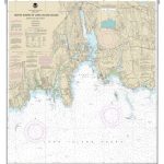
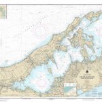
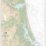
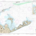
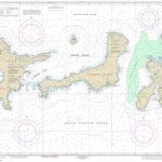
NOAA Chart 12365 – South Shore of Long Island Sound’”Oyster and Huntington Bays
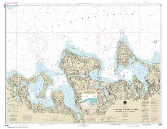
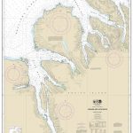
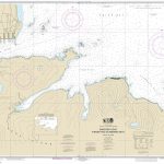
NOAA maintains the nautical charts and publications for U.S. coasts and the Great Lakes. Over a thousand charts cover 95,000 miles of shoreline and 3.4 million square nautical miles of waters.Printed on demand using the most up to date NOAA data and latest Notice to Mariners (NTMs) applied at time of print. Meets United States Coast Guard carriage requirements.Printed in house at Stanfords.

Related Products:
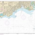
 NOAA Chart 12374 – North Shore of Long Island Sound’”Duck Island to Madison Reef
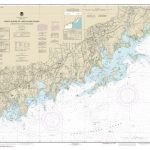
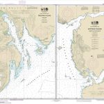
 NOAA Chart 13211 – North Shore of Long Island Sound’”Niantic Bay and Vicinity
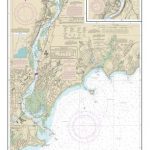
 NOAA Chart 12367 – North Shore of Long Island Sound’”Greenwich Point to New Rochelle
 NOAA Chart 12369 – North Shore of Long Island Sound’”Stratford to Sherwood Point
 NOAA Chart 17367 – Thomas, Farragut and Portage Bays’”Frederick Sound
 NOAA Chart 12368 – North Shore of Long Island Sound’”Sherwood Point to Stamford Harbor
 NOAA Chart 12370 – North Shore of Long Island Sound’”Housatonic River and Milford Harbor
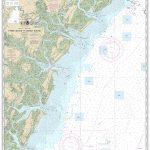
 NOAA Chart 12373 – North Shore of Long Island Sound’”Guilford Harbor to Farm River
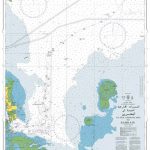
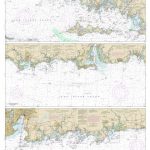
 NOAA Chart 12358 – New York’”Long Island, Shelter lsland Sound and Peconic Bays – Mattituck Inlet
 NOAA Chart 13214 – Fishers Island Sound
 NOAA Chart 17363 – Pybus Bay’”Frederick Sound – Hobart and Windham Bays’”Stephens Passage
 NOAA Chart 11509 – Tybee Island to Doboy Sound
 NOAA Chart 13205 – Block Island Sound and Approaches
 NOAA Chart 18749 – San Pedro Bay – Anaheim Bay Huntington Harbour
 NOAA Chart 12354 – Long Island Sound (eastern part)
 NOAA Chart 12363 – Long Island Sound (western part)
 NOAA Chart 13282 – Newburyport Harbor and Plum Island Sound
 NOAA Chart 11373 – Mississippi Sound and Approaches Dauphin Island to Cat Island
 NOAA Chart 16547 – Sanak Island and Sandman Reefs – Northeast Harbor – Peterson and Salmon Bays – Peterson and Salmon Bays
 NOAA Chart 12366 – Long Island Sound and East River’”Hempstead Harbor to Tallman Island
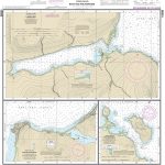
 NOAA Chart 16570 – Portage and Wide Bays
 NOAA Chart 16597 – Uganik and Uyak Bays
 NOAA Chart 11357 – Timbalier and Terrebonne Bays
 NOAA Chart 11389 – St. Joseph and St Andrew Bays
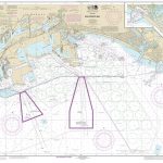
 NOAA Chart 13209 – Block Island Sound and Gardiners Bay – Montauk Harbor
 NOAA Chart 13312 – Frenchman and Blue Hill Bays and Approaches
 NOAA Chart 12372 – Long Island Sound’”Watch Hill to New Haven Harbor
 NOAA Chart 11378 – Intracoastal Waterway’”Santa Rosa Sound to Dauphin Island
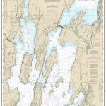 NOAA Chart 14781 – Riviere Richelieu to South Hero Island
 NOAA Chart 17325 – South and West Coasts of Kruzof Island
 NOAA Chart 16599 – Kodiak Island’”Bays and Anchorages – Karluk Anchorage – Larsen Bay – Uyak Anchorage
 NOAA Chart 16467 – Adak Island to Tanaga Island (Metric)
 NOAA Chart 16476 – Sweeper Cove’”Finger and Scabbard Bays
 NOAA Chart 11508 – Altamaha Sound
 NOAA Chart 11517 – St. Helena Sound
 NOAA Chart 25647 – Pillsbury Sound
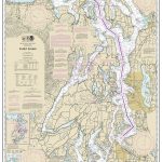 NOAA Chart 18440 – Puget Sound
 NOAA Chart 13215 – Block Island Sound’”Point Judith to Montauk Point
 NOAA Chart 11550 – Ocracoke lnlet and Part of Core Sound
 NOAA Chart 16478 – Tagalak Island to Great Sitkin Island – Sand Bay’”Northeast Cove