Disclosure : This site contains affiliate links to products. We may receive a commission for purchases made through these links.
No Place, Beamish and West Pelton 1895

No Place, Beamish and West Pelton in 1895 in a fascinating series of reproductions of old Ordnance Survey plans in the Alan Godfrey Editions, ideal for anyone interested in the history of their neighbourhood or family. The map covers the village of Beamish (though Beamish Hall and the area now covered by the museum are to the north). It also includes the hamlet known as No Place, Co-operative Villas, and extends east to West Pelton and High Handenhold, which are in the south-eastern corner. The NER Annfield Plain Branch (now part of the C2C cycle path) runs through the map and Beamish station is near the centre. Other features include the Beamish Wagonway, Stanley Wagonway, and Beamish Colliery – East Stanley Pit and Second Pit; also High Urpeth Cottages, Urpeth Burn, Forgebank Plantation, Edenhill Plantation, St Paul`s church West Pelton, saw mills, Beamish Stables, Shepherd & Shepherdess pub, etc. Directory entries for West Pelton and Beamish (or Pit Hill) are on the reverse.About the Alan Godfrey Editions of the 25″ OS Series:Selected towns in Great Britain and Ireland are covered by maps showing the extent of urban development in the last decades of the 19th and early 20th century. The plans have been taken from the Ordnance Survey mapping and reprinted at about 15 inches to one mile (1:4,340). On the reverse most maps have historical notes and many also include extracts from contemporary directories. Most maps cover about one mile (1.6kms) north/south, one and a half miles (2.4kms) across; adjoining sheets can be combined to provide wider coverage.FOR MORE INFORMATION AND A COMPLETE LIST OF ALL AVAILABLE TITLES PLEASE CLICK ON THE SERIES LINK.

Related Products:
 Pelton and Urpeth 1895
Pelton Fell 1915
Stanley 1895
Crook West 1895
East Tanfield and Causey Arch 1895
Burnhope 1895
Stanley 1915
Byker and Heaton 1895
Burnopfield and The Leazes 1895
Gateshead Fell & Sheriff Hill 1895 – 7.05a
South Shields 1895
Low Fell 1895
Pelton and Urpeth 1895
Pelton Fell 1915
Stanley 1895
Crook West 1895
East Tanfield and Causey Arch 1895
Burnhope 1895
Stanley 1915
Byker and Heaton 1895
Burnopfield and The Leazes 1895
Gateshead Fell & Sheriff Hill 1895 – 7.05a
South Shields 1895
Low Fell 1895
 East Boldon 1895
 West Drayton South 1935
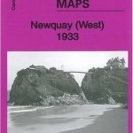 Newquay West 1933
 Bromley Common and North-East Hayes 1895
North West Surrey 1888
Central Croydon 1895 – 14.10
Craghead 1895
Gateshead East 1895
Bromley Common and North-East Hayes 1895
North West Surrey 1888
Central Croydon 1895 – 14.10
Craghead 1895
Gateshead East 1895
 Sedgley South-East with Swan Village and West Coseley 1901
Harton 1895
Lanchester 1895
Sedgley South-East with Swan Village and West Coseley 1901
Harton 1895
Lanchester 1895
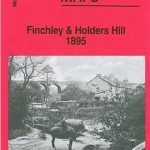 Finchley and Holders Hill 1895
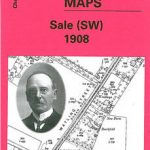 Sale South-West 1908
Annfield Plain 1896
Sale South-West 1908
Annfield Plain 1896
 Shrewsbury West 1900
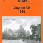 Croydon North-East 1895
New Eltham 1895 – 8.06
Wylam and Clara Vale 1895
Brightlingsea 1895
Rowlands Gill 1895
Mouth of the Tyne 1895
Chester-le-Street 1895 – 13.09a
Croydon North-East 1895
New Eltham 1895 – 8.06
Wylam and Clara Vale 1895
Brightlingsea 1895
Rowlands Gill 1895
Mouth of the Tyne 1895
Chester-le-Street 1895 – 13.09a
 Croydon NW 1895 – 154
Hetton Downs and Rainton Bridge 1895
Croydon NW 1895 – 154
Hetton Downs and Rainton Bridge 1895
 Bromley North and Sundridge Park 1895
 St Albans South-West 1897
South West Berkshire 1889
St Albans South-West 1897
South West Berkshire 1889
 South Croydon 1895 – 14.14