Disclosure : This site contains affiliate links to products. We may receive a commission for purchases made through these links.
Newport 1907 – 95.02
Newport in 1907 in a fascinating series of reproductions of old Ordnance Survey plans in the Alan Godfrey Editions, ideal for anyone interested in the history of their neighbourhood or family. The map covers the central and eastern parts of Newport, with its medieval street pattern. Coverage stretches from Drill Hall Road and The Mall eastward to Staplers Hill, and from Halberry House southward to Great Pan Farm. Features include the town centre, the railway station with track-layout, engine shed, signal box; St Thomas`s church, St Paul`s church, cemetery, Pan Mill, Pan Foundry, St James`s Square, Towngate Bridge, Little London, Hunny Hill, Cross Lane, Barton, Staplers. On the reverse is a list of Private Residents and also of Carriers from an 1899 directory.About the Alan Godfrey Editions of the 25″ OS SeriesSelected towns in Great Britain and Ireland are covered by maps showing the extent of urban development in the last decades of the 19th and early 20th century. The plans have been taken from the Ordnance Survey mapping and reprinted at about 15 inches to one mile (1:4,340). On the reverse most maps have historical notes and many also include extracts from contemporary directories. Most maps cover about one mile (1.6kms) north/south, one and a half miles (2.4kms) across; adjoining sheets can be combined to provide wider coverage.FOR MORE INFORMATION AND A COMPLETE LIST OF ALL AVAILABLE TITLES PLEASE CLICK ON THE SERIES LINK.

Related Products:
 Hopwood Hall and Thornham 1907
Blackrod 1907
Westhoughton 1907
Hopwood Hall and Thornham 1907
Blackrod 1907
Westhoughton 1907
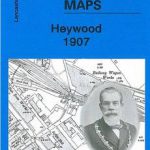 Heywood 1907
Horwich North 1907
Heywood 1907
Horwich North 1907
 Hayes 1907
 Bollington 1907
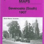 Sevenoaks South 1907
 Sevenoaks North and Riverhead 1907
 Bootle Docks & Seaforth 1907 – 99.13
 Great Driffield 1909
 Lostock Junction 1907
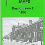 Barnoldswick 1907
 Shortlands 1894
 Bootle 1907
 Hunmanby 1926
New Quay 1904
Hunmanby 1926
New Quay 1904
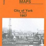 City of York & Clifton 1907 – 174.06b
Griffin`s Hill 1902
Bristol (St George) 1902 – 72.14
Houghton le Spring 1895
Honiton 1903
Torquay 1904
Wigan 1907 – 93.08b
Swanage 1900
Axminster 1903 – 72.05
Dundonald 1902
City of York & Clifton 1907 – 174.06b
Griffin`s Hill 1902
Bristol (St George) 1902 – 72.14
Houghton le Spring 1895
Honiton 1903
Torquay 1904
Wigan 1907 – 93.08b
Swanage 1900
Axminster 1903 – 72.05
Dundonald 1902
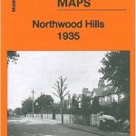 Northwood Hills 1935
 Godalming 1895
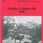 Finchley and Holders Hill 1895
Bewdley 1926
Finchley and Holders Hill 1895
Bewdley 1926
 Castle Douglas 1894
 Ebbw Vale (South) 1899 – 11.14
Willesden and Stonebridge Park 1936
Sheffield (West) 1903 – 294.07b
Ashford (Middx) 1935 – 24.04
Ebbw Vale (South) 1899 – 11.14
Willesden and Stonebridge Park 1936
Sheffield (West) 1903 – 294.07b
Ashford (Middx) 1935 – 24.04
 Croydon NW 1895 – 154
 Castle Bolton, Middleham and Redmire 1910
North Surbiton and South Kingston 1932
East Jarrow 1913
Castle Bolton, Middleham and Redmire 1910
North Surbiton and South Kingston 1932
East Jarrow 1913