Disclosure : This site contains affiliate links to products. We may receive a commission for purchases made through these links.
New Zealand Wall Map
New Zealand Wall Map at 1:1,700,000 fro Gizi Map, size 73.5 x 93.5cm (29″ x 36.5″ approx), presenting an excellent picture of the country’s topography, road network and places of interest, with insets showing the division into administrative regions, plus New Zealand’s position in the South Pacific.The map had altitude colouring with spot heights and plenty of names of various mountain ranges and peaks. National parks are clearly marked. Road network includes selected rural roads and shows intermediate distances on main routes. Railways, domestic airports and main ferry connections are marked and the map also shows internal administrative boundaries with names of the provinces.Symbols highlight various places of interest, including beaches, diving and windsurfing sites, skiing areas, caves, campsites, etc. Latitude and longitude grid is at 1ยบ intervals. The index is on the reverse side. Map legend includes English. Also included are separate distance tables for the North and South islands, an administrative map of New Zealand, plus a map of South-Western Pacific including Australia and most of Indonesia.

Related Products:
 New Zealand Gizi Map
 New Zealand F&B
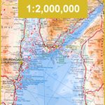
 New Zealand – South Island Reise Know-How
 New Zealand ITMB
 New Zealand Reise Know-How
 North Island – New Zealand Kiwimaps
 New Zealand De Long Wine Wall Map
 A Traveller`s History of New Zealand: and the South Pacific Islands
South Island – New Zealand Hema
A Traveller`s History of New Zealand: and the South Pacific Islands
South Island – New Zealand Hema
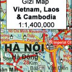 Vietnam – Laos – Cambodia Wall Map
 New Zealand: Kiwimaps 250K Rural Road Maps
 New Zealand Nelles
North Island – New Zealand Hema
New Zealand Nelles
North Island – New Zealand Hema
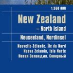 New Zealand – North Island Reise Know-How
 New Zealand NGS Classic Wall Map ENCAPSULATED
 New Zealand Kiwimaps Travel & Touring Map
New Zealand Kiwimaps Travellers Road Atlas
New Zealand Kiwimaps Travel & Touring Map
New Zealand Kiwimaps Travellers Road Atlas
 China Gizi Map Geographical Wall Map
 Saudi Arabia Wall Map
 South Island – New Zealand Kiwimaps
 Oman and United Arab Emirates Wall Map
 Red Sea Wall Map
 Mongolia Geographical Edition Wall Map
 Cuba Wall Map
 New Zealand: Kiwimaps District Road Maps with Street Plans
New Zealand Kiwimaps Pathfinder Road Map
New Zealand: Kiwimaps District Road Maps with Street Plans
New Zealand Kiwimaps Pathfinder Road Map
 South Island – New Zealand Kiwimaps Complete Drivers Atlas
Turkmenistan Gizi Wall Map
India Road Edition Wall Map
South Island – New Zealand Kiwimaps Complete Drivers Atlas
Turkmenistan Gizi Wall Map
India Road Edition Wall Map
 Philippines F&B
 Madagascar F&B
 New Zealand / Aotearoa Hema
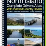 North Island – New Zealand Kiwimaps Complete Drivers Atlas
 Vietnam – Laos – Cambodia Gizi Map
 Myanmar / Burma F&B
 New Zealand Adventure Map
 Iran Wall Map
 Costa Rica Borch
 Egypt Wall Map