Disclosure : This site contains affiliate links to products. We may receive a commission for purchases made through these links.
New Zealand Nelles
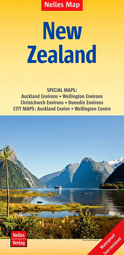
New Zealand at 1:1,250,000 from Nelles, now published on a handy size, light, waterproof and tear-resistant map. North and South Island are presented separately, each on one side of the map, and accompanied by enlargements and street plans of their most visited locations.Topography is indicated by light but effective relief shading, with plenty of names of mountain ranges, peaks, etc. National parks and other protected areas are highlighted. Road network indicates sealed/unsealed roads and includes selected tracks, with distances marked on main routes. Railway lines are included and local airports are marked. Symbols mark various places of interest, including cultural and natural UNESCO World Heritage sites. Latitude and longitude are indicated by margin ticks at 2ยบ intervals. The map is not indexed. Map legend includes English.Enlargements and street plans present in greater detail: on the North Island ‘“ the environs of Auckland and Wellington with city centre street plans; on the South Island ‘“ the environs of Christchurch and Dunedin.


