Disclosure : This site contains affiliate links to products. We may receive a commission for purchases made through these links.
New York City – Manhattan Michelin City Plan and Index

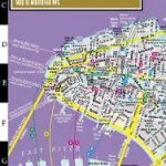
Manhattan at 1:11,000 on a very clear, indexed, double-sided street plan from Michelin, highlighting important buildings, plus a large subway diagram and a road map of a wider area with access to the JFK and Newark Liberty airports.The plan spreads Manhattan over two sides of its long sheet. On one side is southern and central Manhattan extending well beyond the Central Park and Columbia University to 131st Street, with Brooklyn Heights and the adjoining parts of Queens with access to La Guardia Airport. On the reverse coverage of the northern part starts at 126th Street and includes the neighbouring parts of Bronx with Yankee Stadium. Subway stations are clearly marked and the map prominently shows names of various neighbourhoods (Chelsea, Meetpacking District, Greenwich Village, etc). The map highlights principal traffic arteries across the borough, indicates one way streets and shows locations of 24-hour petrol stations. Important buildings/institutions are prominently named. On the reverse, in addition to the street index there is also a separate list of sights. The reverse side also includes a large diagram of the subway network with an enlargement for its southern tip around Wall Street and World Trade Center site, plus a road map of a wider area with access to the JFK and Newark Liberty airports.To see the list of titles in this series please click on the series link.


