Disclosure : This site contains affiliate links to products. We may receive a commission for purchases made through these links.
New York City 5-Borough Rand McNally
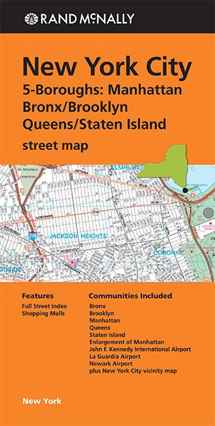
New York City on a combination of street plans from Rand McNally including coverage of all the five boroughs, a detailed plan of Manhattan, layout plans of the main airports, a road map of the city’s vicinity and a map of the subway system.On one side is a street plan of the city’s four main boroughs: Manhattan, Brooklyn, Bronx and Queens; Staten Island is shown on a separate panel on the reverse. The plan shows names of districts, indicates various important buildings and places of interest, and on longer streets gives block numbers.On the reverse Manhattan – up to the Columbia University and 116th Street, and with Brooklyn Heights, parts of Queens and Roosevelt Island – is shown in much greater detail, with subway lines and stations, traffic direction, names of numerous buildings, theatres cross-referenced to a separate list, street index, etc. This title also includes a map of the city’s subway system, a road map of the environs including parts of New Jersey and access to the Newark International Airport, plus layout maps of the terminals at JFK, La Guardia and Newark International airports.Rand McNally street plans provide coverage of cities with their outer suburbs, clearly indicating main traffic arteries: highways (distinguishing between free and toll access), plus primary and secondary routes. Road numbers and/or names are clearly displayed and exit numbers are indicated. Locations of service and rest areas are marked and one way streets are shown. Longer streets are annotated with block numbers for easier identification of addresses. The maps show railway, bus and, where appropriate, metro stations. A range of symbols indicate various places of interest including cultural and academic institutions, various municipal facilities, golf courses, etc. The plans have extensive street indexes, supplemented by lists of points of interest, parks and recreational areas, shopping malls, stations, schools, etc.

Related Products:
 New York City – Manhattan Michelin City Plan and Index
 New York City & Long Island Regional Rand McNally
 Kansas City MO/KS Rand McNally
 Salt Lake City UT Rand McNally
 New York City Borch
 Manhattan & New York State ITMB
 New York City Red Maps
 Birmingham AL Rand McNally
 New York Michelin Citymap
 New York City – Brooklyn – Long Island City Red Maps
 New York F&B City Pocket Map
 Baton Rouge LA Rand McNally
Pittsburgh PA Rand McNally
USA: Rand McNally Street Plans / Regional Maps
Baton Rouge LA Rand McNally
Pittsburgh PA Rand McNally
USA: Rand McNally Street Plans / Regional Maps
 Phoenix AZ Rand McNally
 San Francisco – Northern Peninsula Cities CA Rand McNally
 Jacksonville FL Rand McNally
 San Diego CA Rand McNally
 San Antonio TX Rand McNally
 Syracuse NY Rand McNally
 Houston TX Rand McNally
 Louisville KY Rand McNally
 Rochester NY Rand McNally
Los Angeles CA Rand McNally
Rochester NY Rand McNally
Los Angeles CA Rand McNally
 Atlanta GA Rand McNally
 New York City – SoHo – NoLita – Little Italy Red Maps
 Colorado Springs CO Rand McNally
 Cincinnati OH Rand McNally
 Denver CO Rand McNally
 Boise – Nampa – Caldwell ID Rand McNally
 Sacramento CA Rand McNally
 Albuquerque NM Rand McNally
 St Louis MO Rand McNally
 Columbus OH Rand McNally
 Fort Worth TX Rand McNally
 Anchorage – Fairbanks – Juneau – Ketchikan AK Rand McNally
 Memphis TN Rand McNally
 Fort Lauderdale Metro FL Rand McNally
 New Orleans LA Rand McNally
 Las Vegas – North Las Vegas – The Strip NV Rand McNally