Disclosure : This site contains affiliate links to products. We may receive a commission for purchases made through these links.
New South Wales Hema
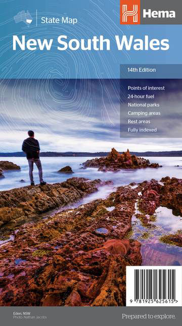
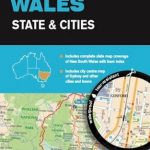
New South Wales at 1:1,150,000 on an indexed road map from Hema with prominent highlighting of its protected areas. On the reverse are street plans of central Sydney and Canberra (the CBDs), a throughroad map of Sydney’s suburbs, a detailed road map of the Blue Mountains National Park with an enlargement of the Katoomba ‘“ Wentworth Falls area, plus a table of facilities in the national parks and a list of information centres.On one side is a state road map, with prominent highlighting for national parks and other protected areas. Road classification indicates sealed and unsealed roads and includes rough tracks. Highways are shown with their names and numbers. Driving distances are marked on main and many local routes. The map also shows locations of 24-hrs fuel stations and of selected diesel and unleaded/Opal stations. Other symbols indicate different types of rest areas, caravanning and camping sites, visitor information offices, and various points of interest. Latitude and longitude lines are drawn at 1ยฐ intervals. The index is next to the map, together with a distance table.On the reverse, detailed CBD street plans highlight various facilities and sights (32 in Sydney and 59 in Canberra) and selected accommodation (57 and 21 respectively). More detailed road maps present the Blue Mountains National Park (with a further enlargement of the Katoomba ‘“ Wentworth Fall area) plus the Sydney region. Also provided is a table showing facilities available in the national parks plus a list of local information centres.To see the list of Hema’s maps of other states of Australia please click on the series link.

Related Products:
 Outback New South Wales – from Broken Hill to Tamworth Hema Explorer Map
 North East New South Wales Hema
 Melbourne to Sydney Hema
 North East New South Wales – Coffs Harbour to Brisbane Hema Explorer Map
 Western Australia Hema
 South West Western Australia Hema
 Mid West Western Australia Hema
 South Australia Hema
 Sydney and Region Hema
 South Island – New Zealand Hema
 South West Corner – Margaret River & Southern Forest Hema
 Sydney to Brisbane Hema
 Central Queensland Hema
 Central Queensland – Hervey Bay to Mackay Hema
 Queensland Hema
 Victoria Hema
 Pilbara and Coral Coast Hema Waterproof Map
Tasmania Hema
Pilbara and Coral Coast Hema Waterproof Map
Tasmania Hema
 Northern Territory Hema
 Melbourne to Adelaide – featuring the Great Ocean Road and Victorian Goldfields Hema Touring Map
South East Queensland – featuring Landcruiser Mountain Park Hema Explorer Map
Melbourne to Adelaide – featuring the Great Ocean Road and Victorian Goldfields Hema Touring Map
South East Queensland – featuring Landcruiser Mountain Park Hema Explorer Map
 Outback Queensland Hema
 Top End National Parks: Litchfield – Katharine – Kakadu Hema
 South East Queensland Hema
 Sydney Borch
 Australia: Hema State Road Maps
Outback Queensland – Camooweal to Stanthorpe Hema Explorer Map
Australia: Hema State Road Maps
Outback Queensland – Camooweal to Stanthorpe Hema Explorer Map
 New South Wales State & Cities UBD Gregory`s 219
North Island – New Zealand Hema
New South Wales State & Cities UBD Gregory`s 219
North Island – New Zealand Hema
 Red Centre – Alice Springs to Uluru NT Hema
North Queensland – from Cape York to Mackay Hema Explorer Map
Red Centre – Alice Springs to Uluru NT Hema
North Queensland – from Cape York to Mackay Hema Explorer Map
 Australia Hema Motorcycle Atlas Set – 200 Top Rides SPIRAL-BOUND
 Brisbane to Cairns Hema
 Baja California South State – La Paz
 Savannah Way – Cairns to Broome Hema Touring Map
 Saskatchewan Back Road Atlas
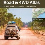 Australia Hema Road & 4WD Atlas PAPERBACK
 New Zealand Hema Touring Atlas A4 SPIRAL-BOUND
 Wales – South West England – Midlands Michelin Regional 503